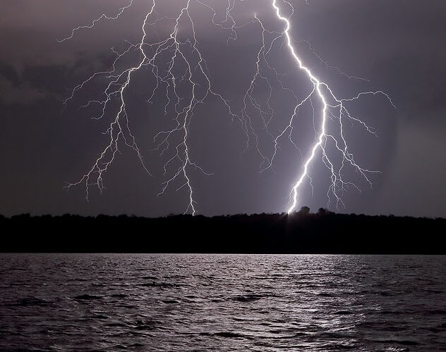
A tranquil evening at the lakeshore, this was not. The back side of a right-moving supercell passed a few miles to the northeast, occasionally blasting brilliant sparks through the sky. The forward-flank core is well-defined at distant rear, and the broad, nontornadic, modestly organized mesocyclone area is behind and to the left of the lightning in this image. I was glad to see no boats on nor … [Read more...]
Temporary Wrapping
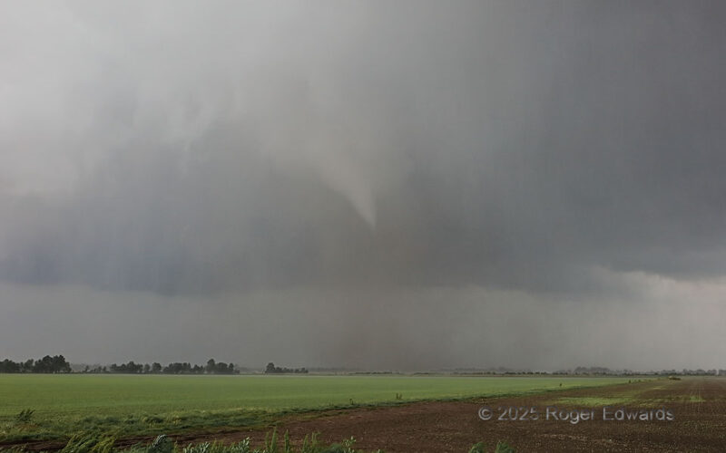
As this "roaring bowl" tornado translated quickly away from us to the E, and toward the Mississippi River, it finally developed a narrow, somewhat shallow condensation funnel, still much smaller than the actual tornadic winds better represented by the approximate width of the dust plume. Given the speedy nature of the parent supercell, and the rain wrapping around the tornado (a temporary … [Read more...]
Kilauea Firehose
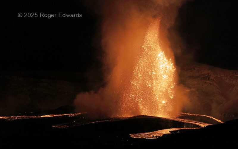
Just before the crack of dawn, Kilauea's "Episode 33" eruptive pulse, which mainly had been pumping out a skyscraper-sized fountain from the northern of two active vents, began pouring lava across the crater floor from the south vent (behind the fountain), in two streams: far left and rightmost. Meanwhile, the fountaining north vent also overflowed at ground level in two directions of its own, … [Read more...]
Last Arnett Tornado
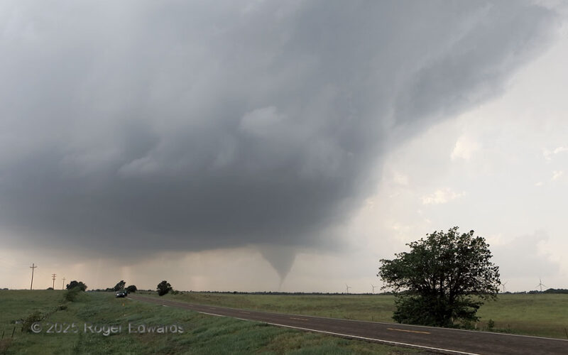
No, this won't be the last Arnett tornado for ever and ever, but it was the final one from this supercell, even though the storm itself would spin northeastward for another couple hours before dissipating near the Kansas border. Why it stopped after this is rather mysterious, since it was moving into progressively greater moisture, stronger low-level shear and similar buoyancy. The storm became … [Read more...]
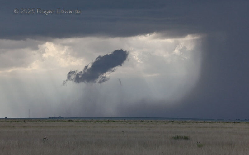
Rain Foot Scud Lift
Wandering southward off the Raton Mesa with early storms, on what would become a legendary structure day (but not from this convection), I noticed a remarkable tracing of the flow from cloud to ground and back to cloud again. The absolutely classic rain foot at right surged a plume of cold outflow southward then upward in a great big toroid. That curvy-rising outflow air was cooler and moister … [Read more...]
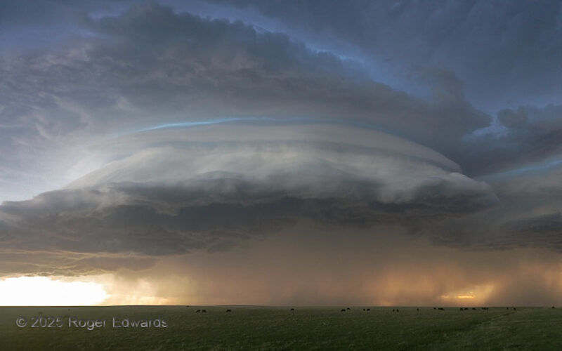
Colorado Curvature
With area storms being high-based and merging into others in a previously broken line, outflow was destined to surge ahead, and this fabulous structure wouldn't (and didn't) last long. Nonetheless, for a precarious yet precious several minutes, a high-based supercell on the High Plains of northeast Colorado put on a dazzling show of cloud structure and golden-hour coloration. It was a blessing … [Read more...]
- « Previous Page
- 1
- …
- 12
- 13
- 14
- 15
- 16
- …
- 413
- Next Page »