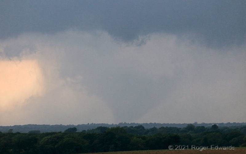
My first view of the Blum tornado was this: a fat, tapered, rain-wrapped cone emerging from dense precip obscuration, in an old mesocyclone. How long had this tornado existed before? Even after the fact, it's hard to say, as in its early life cycle, there was little to damage. I reported this to NWS Fort Worth right away, upon recognizing and gaining confidence in what this was. The tornado … [Read more...]
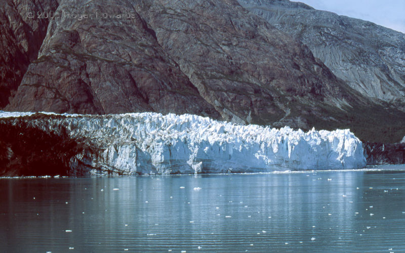
Margerie Glacier Reflective
Ice floes dot Glacier Bay from several sources, especially the tidal Margerie Glacier. Ice flows thousands of feet downhill to this place, where it slowly calves off, rafts off and melts off. The middle part of the glacial wall was quite fascinating and photogenic in its own right as we approached. 76 NW Hoonah AK (31 Jul 3) Looking SSE 59.044, -137.0409 … [Read more...]
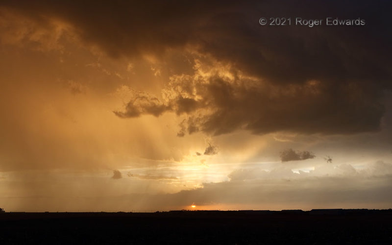
Super Sidney Sunset
As a train of mostly disorganized and structurally nondescript storms had paraded past, we "called off the chase" and had dinner in town, with an eye toward resuming the viewing in the later sunset hour. Good thing we did! The light behind the band of messy storms briefly shone a deep gold, warmed and diffused by several miles of intervening rain. A few western meadowlarks braved the precip and … [Read more...]
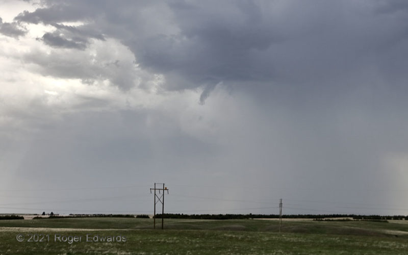
High-Based Funnel
Destructive interference from close-proximity development of numerous high-based storms kept substantial, large updrafts from taking root long enough to organize into sustained supercells on a day otherwise favorable in the parameter space. This became readily apparent as we watched one small, high-based updraft after another race past in a train of convection, moving more with the midlevel flow … [Read more...]
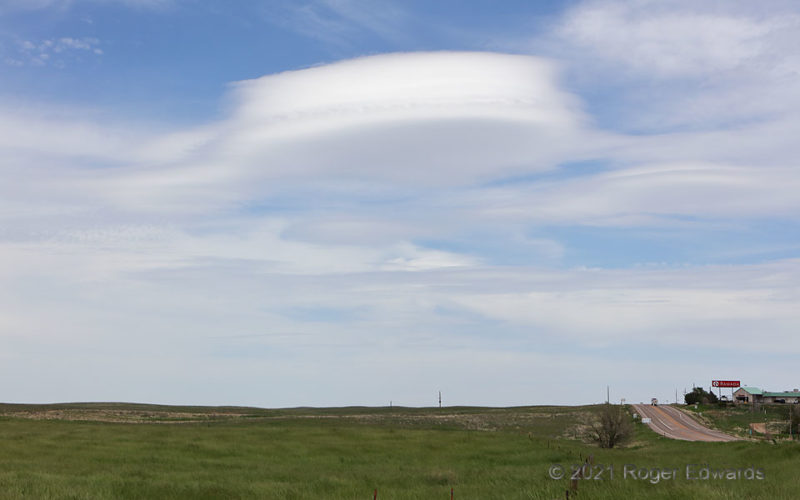
Sterling Lenticular
A "sterling" example of "altocumulus lenticularis" (lens cloud) sped over the part of Colorado most removed from mountains, at the same time thunderstorms were forming just 30–60 miles to the southwest. Aviators avoid such clouds, as they reveal the presence of rough waves aloft that can severely jostle and perhaps damage aircraft, and cause injury within. The old Surface Aviation Observation … [Read more...]
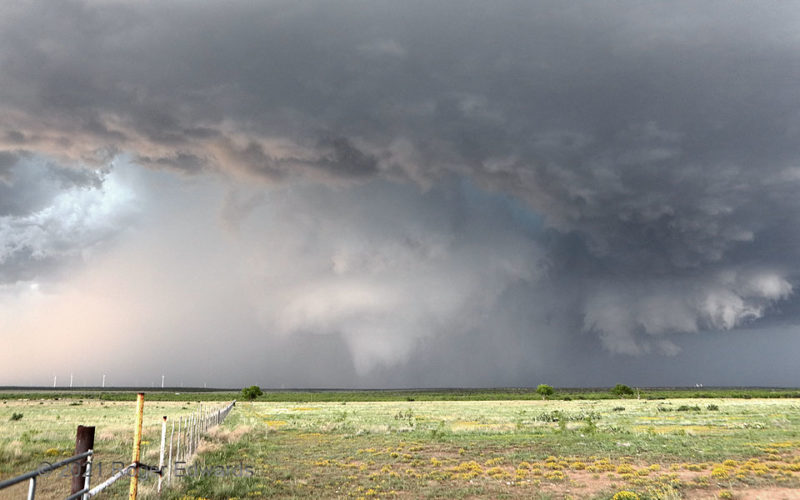
Sterling Tornadic Circulation
Our second vantage of the Sterling City tornado mostly was obscured by wrapping rain and hail, though we intermittently could hear its whooshing noise "somewhere in there". Fortunately, the dense precip curtains thinned just long enough to reveal a fat, truncated condensation funnel with multiple vortices whirling beneath, and surrounded aloft by a very rapidly rotating wall cloud. This … [Read more...]
- « Previous Page
- 1
- …
- 124
- 125
- 126
- 127
- 128
- …
- 418
- Next Page »