Having been initially out of position for earlier supercells forming near an outflow-reinforced warm front and producing a brief tornado or two each, we zipped north from the Channing area to see if newer and nearer towers, visible to our north, could grow into a storm and achieve the same feat. They most certainly did, and then some. The resulting supercell became the longest-lived "anchor … [Read more...]
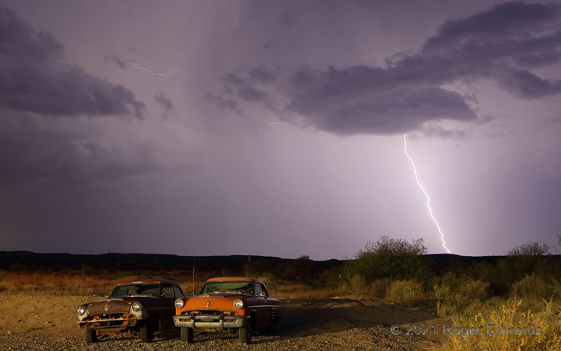
Lightning and Classic Cars
A pair of old Mercury sedans rested on the desert floor as a thunderstorm receded away. Out there in a dry climate, sun-beaten almost daily, these cars will deteriorate, but at a much-slower rate than areas that get more rain, hail and snow. Benson AZ (12 Jul 21) Looking WSW 31.9816, -110.3082 … [Read more...]
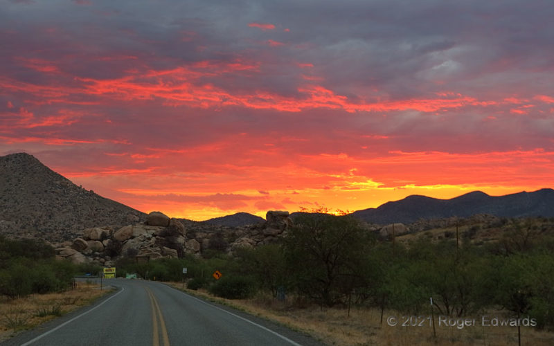
Sunset at Texas Canyon
Remove the highway and the signs, and this marvelous Western sunset across Arizona's Texas Canyon country could have been witnessed by emigrants on the mid-1800s Butterfield stage trail. Appreciation of its beauty would have been distracted, however, by vigilance for Apache attacks and venomous animals. Having no concern of the former and merely checking underfoot for the latter, it was much … [Read more...]
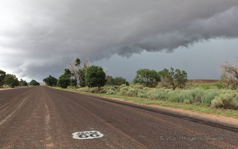
Route 66 Arcus
Here's a rare opportunity: standing astride a state border while shooting a scenic cloud formation, with an iconic symbol in the foreground. Behind me, in New Mexico, the road soon went to unimproved gravel and gully-washed dirt, miserably deteriorated from its heyday, and in disappointingly poor condition for such a historically important strand of Americana. Fortunately, the best part of the … [Read more...]
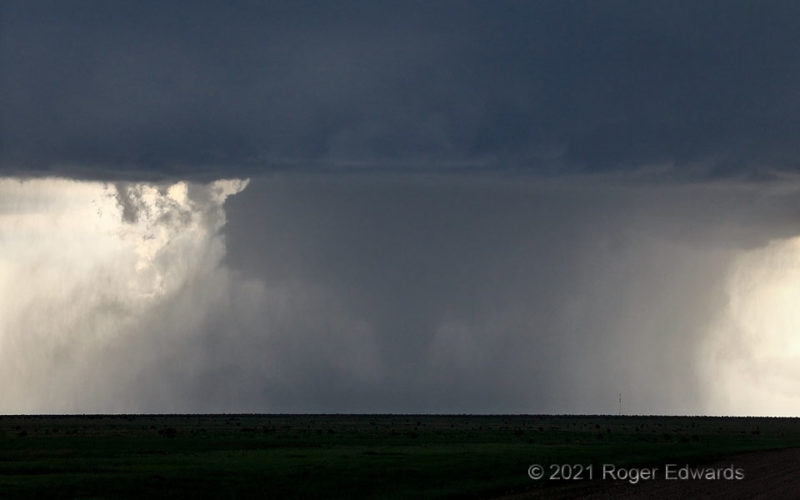
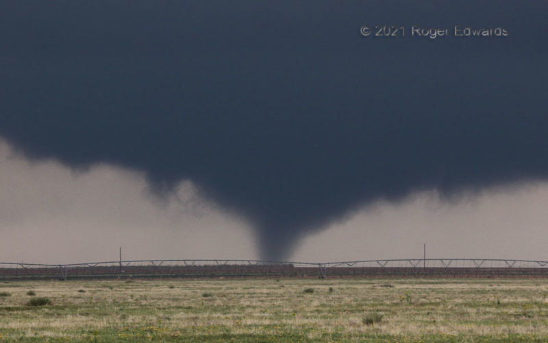
Campo-21 Zoom
A thick, densely rain-wrapped tornado from a rather high-based High Plains storm obviously can happen (here it is and here's another from 8 years earlier!), but isn't common in my experience. In the southeast and sometimes lower Plains, where smaller dewpoint depressions and less evaporative cooling happen, tornadoes can (and often do) generate within dense precip, and can last a long time. … [Read more...]
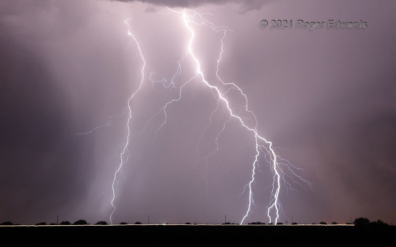
Eloy Electricity
An electrically prolific, high-based multicell thunderstorm cluster flung over 100 cloud-to-ground lightning flashes within view on this moist southern Arizona evening. I managed to catch about 80 of them on camera. Here are three of the closest, including one with a branched bottom (at right). Their differences in brightness mainly relate to how much of the storm's rain core was falling … [Read more...]
- « Previous Page
- 1
- …
- 117
- 118
- 119
- 120
- 121
- …
- 413
- Next Page »