After the McLellan Lake tornado of 20 May 99, I didn't expect to see another obviously closed, ground-contacting vortex that could compete for the ignominious title of "weakest tornado I've seen". This was that. Under a broadly rotating, seemingly modest mesocycloic notch in this storm's updraft area, scud began to rise and turn slowly, right up from ground level, gradually condensing into a … [Read more...]
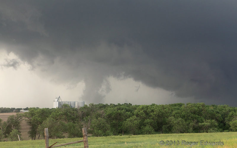
Stockton Tornado and RFD Cut
A classic Kansas tornado developed from a supercell we watched from the very first dryline towers, until nearly simultaneous supercell and tornado dissipation north of the warm front. The bright, relatively clear area above-left of the tornado, allowing more-direct sunlight through, was a cloud gap cut by the inner part of the rear-flank downdraft wrapping around the mesocyclone and supporting … [Read more...]
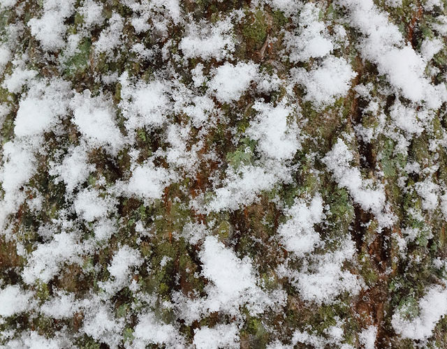
Bark Snow
Clumps of wet snow stuck to outreaching areas of bark on the north sides of trees during central Oklahoma's New Years Day 2021 snow event. The high-adhesion, wet aggregates decorated those outer windward surfaces, while the moss that also festooned the north sides (albeit less ephemerally) provides the green in the trenches. Norman OK (1 Jan 21) Looking SSW … [Read more...]
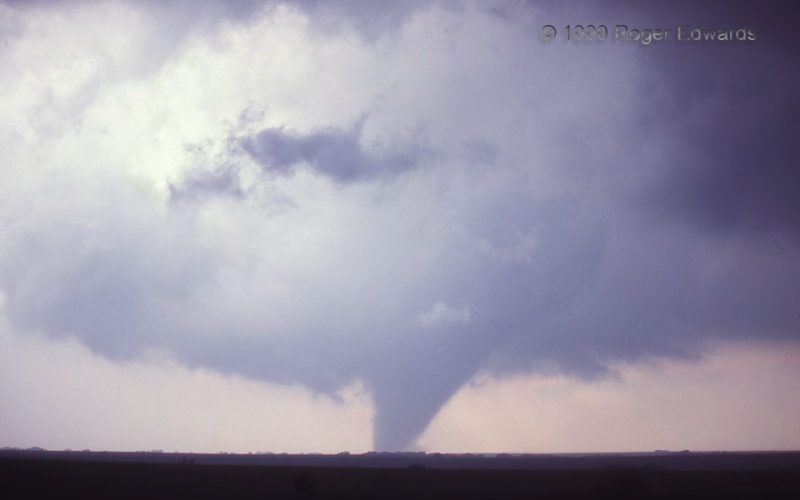
Belmont Tornadic Supercell
This dense, heavy-precip (HP) supercell, embedded in a broken but solidifying line of storms, was tornadic. That's not a curved rain shaft at lower middle, to the left of the wall cloud. It's a tornado from an old, deeply occluded and rain-wrapped mesocyclone. Continuity of observing this storm affirmed this much better than a single-time sample would, such as either this photo, or what you … [Read more...]
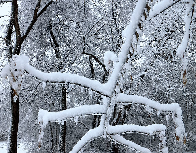
Sticky Stacks
A heavy, west, sticky snowfall, coating the north faces of many well-exposed tree trunks, piled up on thin twigs and small branches. This happened despite the presence of 15-25-mph north winds through much of the event, which normally would both shake and directly blow the snow off. The limbs shook, but the snow stuck. This snow was so moist and dense that it fell in large aggregates, and had … [Read more...]
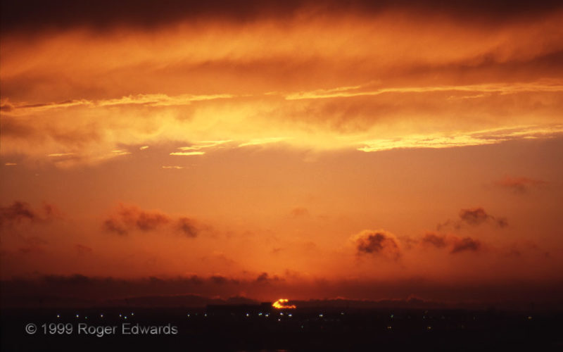
Sunset 99
This was somewhere between the 99th sunset I had admired (long ago as a kid) and the 99th I had photographed (not keeping count, but probably sometime in the 2000s). But it was the first photogenic sunset of 1999, as seen from the roof of the former NSSL/SPC facility on the OU North Campus. Scuddy fractocumulus rags wafted southward in the cool outflow, produced by the same area of convection … [Read more...]
- « Previous Page
- 1
- …
- 108
- 109
- 110
- 111
- 112
- …
- 386
- Next Page »