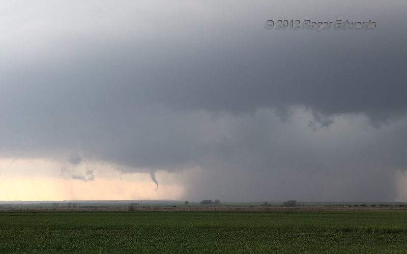
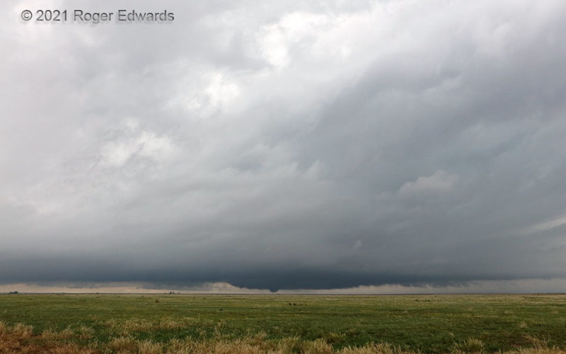
Beneath some fairly wondrous structure, a contorted little funnel appeared, just south (leftward) of the storm's farthest, most dense core area. Brief connections of the condensation funnel with ground, along with occasional debris whirls, confirmed this was a tornado, and a clockwise-spinning one at that. Yes, anticyclonic tornadoes can occur from cyclonic supercells; this one was just off the … [Read more...]
Travelers’ Thunder
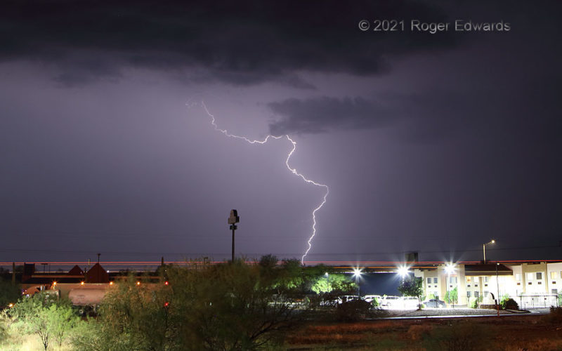
Travelers had to deal with lightning on this fine, rainy Arizona evening. Along Interstate 10 in the background, vehicles of assorted sizes whizzed along through and around the storm, their taillights visible in this time exposure as red streaks. Others like me, already at their motels, either heard the thundery spectacle from within their lodging, or took in the show on balconies of motels that … [Read more...]
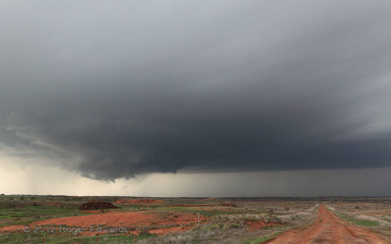
Wall Cloud and Red Dirt Road
Prior to producing its first tornado, a supercell got better organized, with a large updraft base preceding a growing wall cloud. This is a quintessential southwestern Oklahoma scene, the sparse vegetation of a semiarid climate interspersed with exposed areas of red-clay soil on either side of the primitive road. In wetter conditions, this path would be deeply rutted, extremely slick … [Read more...]
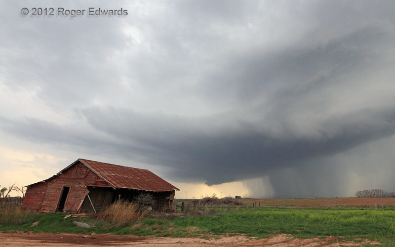
Young Supercell behind Abandoned Farmhouse
Organizing into a supercell, this young storm made a fine backdrop for an abandoned farmhouse whose sheet-metal roof clattered and banged back and forth in the moist southeasterly breezes. The storm would move NE across the rolling red-dirt plains of southwestern Oklahoma, before merging with a younger cell and assuming a spectacular bell shape. 3 E Hollis OK (18 Mar 12) Looking WSW 34.6825, … [Read more...]
Warm-Frontal Tornadic Supercell: Wide View
After several zoomed-in photos of the first Conlen tornado, I quickly grabbed the other camera for a wide view, during a bowl-shaped condensation phase that immediately preceded the tornado's demise. Supercells on the immediate cool side of a warm front still may access surface-based instability, as this one obviously did by spawning tornadoes, but tend to have thicker intervening low clouds, … [Read more...]
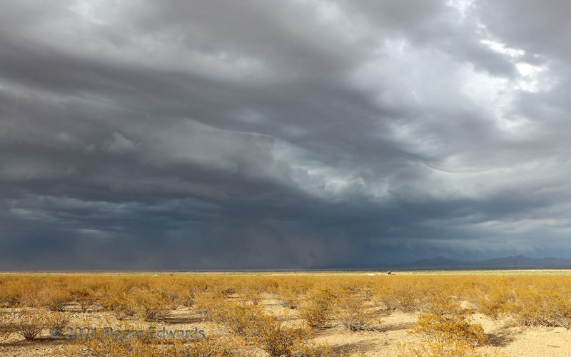
Chaotic Convective Cloudscape
As often happens in these parts, convection that blew up hours before in the higher mountains north of I-10 aggregated together, with the collective outflow rushing into a well-heated boundary layer on the desert floor. That, in turn, set off more thunderstorms, which pulsated the outflow/convective cycle along well southward into the borderlands. Dust raised readily from the dry lake bed west … [Read more...]
- « Previous Page
- 1
- …
- 103
- 104
- 105
- 106
- 107
- …
- 418
- Next Page »