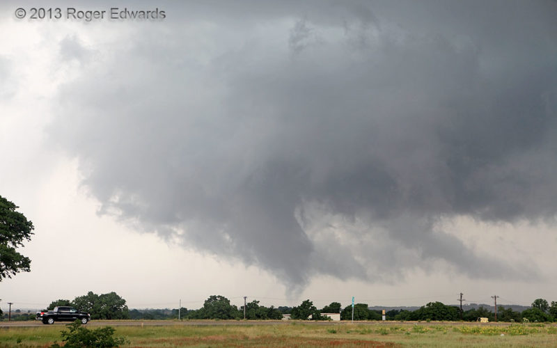
After a protracted, slow-moving spectacle of supercell structure and a couple tornadoes, the former Millsap supercell developed a new mesocyclone very close to, perhaps even somewhat over I-20, which then retreated slightly northward and deeper into the storm before producing this fuzzy, tilted, conical, sporadically multivortex tube. Drivers were very fortunate that this supercell didn't spin … [Read more...]
Tornadic Trunk
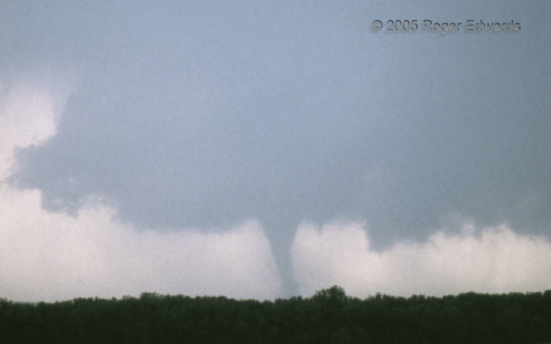
The Hill City tornado from 2005 is shown here with its ambient wall cloud, a couple minutes before a somewhat more-zoomed shot, using the same unknowingly and unexpectedly grainy roll of slide film. Still, this supercell offered us a memorable afternoon of storm observing, starting with the eruption of this supercell just east of the dryline, and several miles southeast of our position at the … [Read more...]
In and Out in a Flash
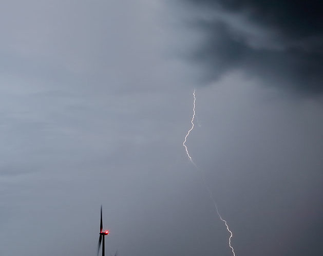
Later and to the west of a profuse round of in-cloud and cloud-to-air lightning, a few cloud-to-ground flashes decorated the trailing precipitation region of the storms to my north. This one traveled through a tilted rain core along its path of least resistance. A short time exposure let in only a little ambient late-twilight light, yet still blurred the moving clouds, creating a rather … [Read more...]
Twin Twilight Flashes
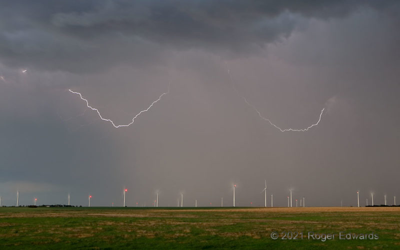
Twin twilight flashes dipped in and out of a rainy thunderstorm base above a large central Kansas wind farm. I was struck, not by the lightning (fortunately), but by the two-dimensional symmetry of these discharges above the gently arching skyline of wind-energy turbines. The surrounding countryside and sky were darker than this, but time exposure drinks in more light, making a deep twilight … [Read more...]
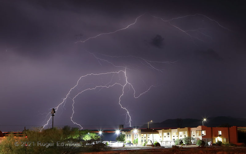
3 CGs and Crawlers
This was one of several lightning episodes I shot from in, or an easy stroll of, the small motel where I was staying for the night. Here, seen from the building's south-facing upstairs balcony, three cloud-to-ground strikes that appeared to have a common source, and a variably bright burst of crawlers, erupted in one visually perceived flash, beyond the traffic of Interstate 10. Horizontal red … [Read more...]
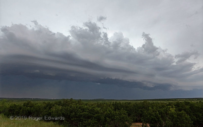
Convective Arcus
Seasoned Great Plains storm observers often find a late-day supercell absorbed into a nearby line of multicell thunderstorms that evolves into a photogenic but outflow-dominant complex of convection. This was no exception. Some of that convection can be seen here as deep towers directly atop the shelf cloud, where air parcels are forced by lift from the cold density current to slide up over the … [Read more...]
- « Previous Page
- 1
- …
- 100
- 101
- 102
- 103
- 104
- …
- 413
- Next Page »