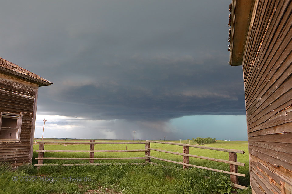
Two abandoned schoolhouses, and the fencing between them, fortuitously pointed many lines at a rapidly organizing mesocyclone, with a wall cloud condensed partly of rain-cooled forward-flank air. Half an hour before, this storm didn’t exist; it erupted rapidly from deep convective towers lining a horizontal convective roll (HCR). The HCR, in turn, had existed for a long time, but its lift strengthened in the inflow region of a larger complex of storms (distant left background), that itself included a long-lived supercell. Though the newer storm would strengthen fast and further, it also got absorbed into the complex, adding its burgeoning reservoir of cyclonic vorticity to that contributed by the original supercell. The atmosphere, and its convective processes in particular, fascinate me to no end! Every year, I witness many unique events and scenes across the Great Plains. This definitely was a standout, in both respects.
4 N Wicksville SD (12 Jun 22) Looking NNW
44.1772, -102.588
