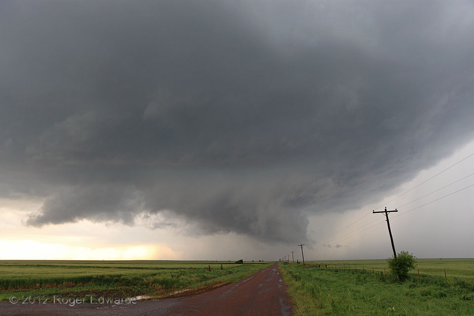
 Along a persistent, east-northeast/west-southwest-oriented convergence axis, the youngest occlusion of a cyclic, somewhat wet, classic supercell spun forth a small but vigorous mesocyclone, part of which manifest visually in the form of this wall cloud. Although it displayed strong convergence and rising motions, only weak to moderate rotation appeared—never strong or tight enough for me to be concerned of imminent tornadogenesis. Still, throughout this cycle, the storm remained beautiful with a classically formed wall cloud.
3 N Duke OK (13 Apr 12) Looking W
34.7103, -99.5664
Along a persistent, east-northeast/west-southwest-oriented convergence axis, the youngest occlusion of a cyclic, somewhat wet, classic supercell spun forth a small but vigorous mesocyclone, part of which manifest visually in the form of this wall cloud. Although it displayed strong convergence and rising motions, only weak to moderate rotation appeared—never strong or tight enough for me to be concerned of imminent tornadogenesis. Still, throughout this cycle, the storm remained beautiful with a classically formed wall cloud.
3 N Duke OK (13 Apr 12) Looking W
34.7103, -99.5664Young Duke Wall Cloud
 Along a persistent, east-northeast/west-southwest-oriented convergence axis, the youngest occlusion of a cyclic, somewhat wet, classic supercell spun forth a small but vigorous mesocyclone, part of which manifest visually in the form of this wall cloud. Although it displayed strong convergence and rising motions, only weak to moderate rotation appeared—never strong or tight enough for me to be concerned of imminent tornadogenesis. Still, throughout this cycle, the storm remained beautiful with a classically formed wall cloud.
3 N Duke OK (13 Apr 12) Looking W
34.7103, -99.5664