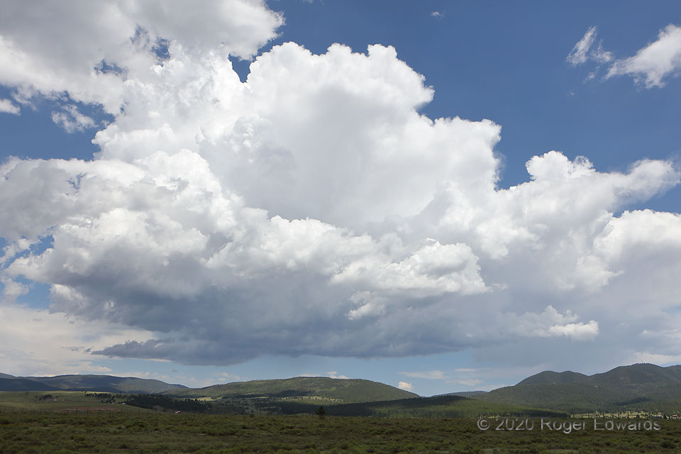
 Forget mountain-grown coffee. I’ll take a big cup of mountain-grown convection, please. In the warm season, after the dryline has disappeared in favor of moisture from the North American Monsoon, “recycled” moisture advected upslope behind the passage of weak cold fronts, and/or or where a more direct fetch of Gulf air can back right up to the mountains, we see activity such as this often on the high terrain of northern New Mexico. When enough deep shear exists for supercells, storm chasers appear as moths to light, sitting in high spots along any of the few good Plains roads east of here, awaiting the emergence of a dominant storm as a supercell. On this day, only weak supercells and multicells were in the picture under modest north-northwesterly flow aloft, so I first journeyed into the highlands to observe their development closer, until convective potential increase on the Plains. This nice, early-stage cumulonimbus barely was glaciated, with some rain already fallen from a small cell flanking it to the right (south).
Angel Fire NM (3 Aug 20) Looking ENE
36.4161, -105.2947
Forget mountain-grown coffee. I’ll take a big cup of mountain-grown convection, please. In the warm season, after the dryline has disappeared in favor of moisture from the North American Monsoon, “recycled” moisture advected upslope behind the passage of weak cold fronts, and/or or where a more direct fetch of Gulf air can back right up to the mountains, we see activity such as this often on the high terrain of northern New Mexico. When enough deep shear exists for supercells, storm chasers appear as moths to light, sitting in high spots along any of the few good Plains roads east of here, awaiting the emergence of a dominant storm as a supercell. On this day, only weak supercells and multicells were in the picture under modest north-northwesterly flow aloft, so I first journeyed into the highlands to observe their development closer, until convective potential increase on the Plains. This nice, early-stage cumulonimbus barely was glaciated, with some rain already fallen from a small cell flanking it to the right (south).
Angel Fire NM (3 Aug 20) Looking ENE
36.4161, -105.2947Young Cumulonimbus
 Forget mountain-grown coffee. I’ll take a big cup of mountain-grown convection, please. In the warm season, after the dryline has disappeared in favor of moisture from the North American Monsoon, “recycled” moisture advected upslope behind the passage of weak cold fronts, and/or or where a more direct fetch of Gulf air can back right up to the mountains, we see activity such as this often on the high terrain of northern New Mexico. When enough deep shear exists for supercells, storm chasers appear as moths to light, sitting in high spots along any of the few good Plains roads east of here, awaiting the emergence of a dominant storm as a supercell. On this day, only weak supercells and multicells were in the picture under modest north-northwesterly flow aloft, so I first journeyed into the highlands to observe their development closer, until convective potential increase on the Plains. This nice, early-stage cumulonimbus barely was glaciated, with some rain already fallen from a small cell flanking it to the right (south).
Angel Fire NM (3 Aug 20) Looking ENE
36.4161, -105.2947