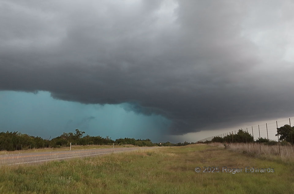
Already an outflow-driven, heavy-precip storm by the time it approached Menard, this storm enlarged, turned hard right (southeast), and became deeply rain-wrapped, appearing on radar in a form that sometimes earns the nickname “landcane” for its spiraled arms. One of those was the dense, intense precip arc seen at left, the rear-flank core, full of deep turquoise tint, large hail and strong to severe wind, curving south and southwest from the unseen low-level mesocyclone at distant left of the highway. I’m not a big fan of chasing in the Hill Country, especially the more forested parts, so with the storm churning down the highway toward us, this quick peek was good enough. We then trned right back around tot he southeast, headed into Fredericksburg to find a place to ride it out safely under cover from up to 2-inch hail, then had a great German dinner.
13 NW Fredericksburg TX (26 May 25) Looking NNW
30.4304, -98.9729