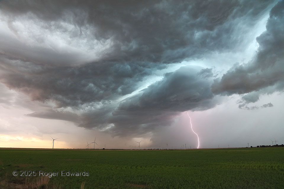
The “blast” part of the title can represent either the CG at right, or the sudden onset of cold wind soon after this shot. A long-lived, fast-moving, highly electrified supercell that started over east Amarillo, ended here, where it gusted out and merged with a larger, growing thunderstorm cluster. In the process, its “whale’s mouth” shelf-cloud region contorted into a fascinatingly layered form, as the convective outflow beneath coursed through a wind farm. One can mark the position of the gust front by where the blades face the east in the foreground and are visible, versus where they face north-northwest in the distance and in the storm’s cold pool.
1 ESE Vera TX (8 Jun 25) Looking WSW
33.6283, -99.5497