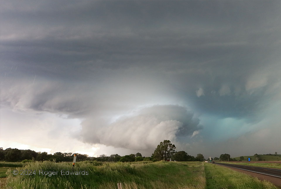
A product of the merger of two supercells west-northwest of Broken Bow this big, complex and quite severe supercell sported two mesocyclones, one nearly wrapped in rain to my south-southwest. This one, viewed from the “notch” inflow area just off the forward-flank core, drew a lot of hail-cooled air from that core (foggy, yellowish cast behind the road and trees to the right). It then condensed the inflow/outflow mix into a wall cloud and swirled it helically into the storm, as you can imagine by placing your right hand over the tree and twisting it to the right and upward. Looking down from the storm’s position, this is cyclonic motion, and appeared to come very close to producing a tornado. The odd light of the cloud comes from the eastern and southern sky, mainly, filtered through some precip and dust, while a turquoise tinge dominated the inner notch and vault regions. Unfortunately, the same part of such a storm that affords such a view also tends to fling cloud-to-ground lightning in furious bursts, and one such episode kept me in the vehicle for this one, unable to move to the side enough to get that tree out of the way. So while this shot won’t make the cover of a major national magazine, it still illustrates the strange and eerie viewing and process deduction that every supercell offers, in its own unique way.
3 NW Berwyn NE (7 Jun 24) Looking WNW
41.3644, -99.5572