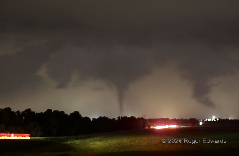
After two other nighttime tornadoes between Union City and Yukon spun into oblivion (dissipation and/or rain), the Union City cone emerged from rain in an older mesocyclone, and began retrograding westward (leftward). If someone looks only at a map of the tornado tracks, this one may appear to have translated opposite reality. Why such a peculiar path direction in an eastward-moving parent supercell? Here, the narrowing cone, silhouetted by precip-diffused lights of Union City, is following the track of the deeply occluded mesocyclone that, as often happens with cyclic supercells, is being kicked out the rear of the storm. Once it dissociates entirely from the storm and any related, remnant updraft, the tornado will die. One lesson here is that being close behind or upshear of a cyclic, tornadic supercell at night is no guarantee that the tornado will remain east of the observer. If within a few miles of the supercell, a position abeam of it and in the southern inflow region or extended RFD may be safer.
2 NNE Minco OK (19 May 24) Looking NNW
35.3393, -97.9337