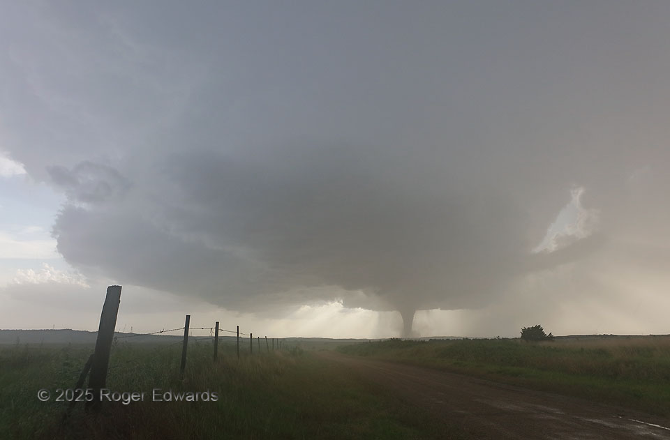
Through a translucent portion of this stout supercell’s main precipitation area, a substantial stovepipe tornado continued to churn up the southwestern Nebraska landscape. This wide view includes the inflow tail at left,and downshear tail cloud at right, which curved along the inner rim of the same forward-flank core that bent southeastward and just overhead. Despite the seeming robustness of the tornado, this whole spectacle marked the final few minutes of over an hour of nearly continuous tornado production from the same part of the slow-moving storm.
1 NW Wellfleet NE (16 Jun 25) Looking WNW
40.7716, -100.741