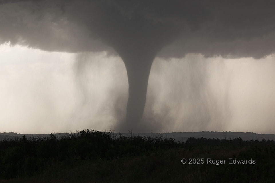
Condensation of the long-lived and high-contrast “Wellfleet tornado” widened from a classical elephant-trunk shape to near its greatest apparent breadth during this stage, curiously, soon before dissipation. What had been very little precipitation around the low-level mesocyclone increased visibly, wrapping mainly northwest to southwest of the vortex in graceful-looking, curvy shafts, as the whole supercell got a little more precip-laden.
1 NW Wellfleet NE (16 Jun 25) Looking WNW
40.7716, -100.741