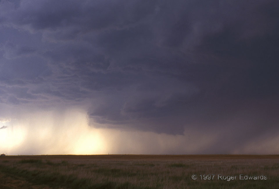
 Most wall clouds do not produce tornadoes, including this scenic Oklahoma Panhandle specimen. Every wall cloud must be closely watched and reported by spotters, though. Here, precipitation curtains can be seen wrapping around the rear (W) side; but the wall cloud only rotated slowly before being undercut by wet outflow. Without strong storm inflow winds, high-based supercells like this will often shoot outflow winds from the forward flank precip area (at right) under the updraft and out into the weak-inflow area (where the picture was taken). Such outflow dominance is fatal to most storms; but a few (including this one) will last much longer as elevated supercells over the top of the cool and stable air near ground. This storm persisted through a nice mammatus show to yield a classically stunning Great Plains sunset.
3 N Hough OK (29 Jun 97) Looking WNW
36.9066, -101.578
Most wall clouds do not produce tornadoes, including this scenic Oklahoma Panhandle specimen. Every wall cloud must be closely watched and reported by spotters, though. Here, precipitation curtains can be seen wrapping around the rear (W) side; but the wall cloud only rotated slowly before being undercut by wet outflow. Without strong storm inflow winds, high-based supercells like this will often shoot outflow winds from the forward flank precip area (at right) under the updraft and out into the weak-inflow area (where the picture was taken). Such outflow dominance is fatal to most storms; but a few (including this one) will last much longer as elevated supercells over the top of the cool and stable air near ground. This storm persisted through a nice mammatus show to yield a classically stunning Great Plains sunset.
3 N Hough OK (29 Jun 97) Looking WNW
36.9066, -101.578Wall Cloud in No-Man’s Land
 Most wall clouds do not produce tornadoes, including this scenic Oklahoma Panhandle specimen. Every wall cloud must be closely watched and reported by spotters, though. Here, precipitation curtains can be seen wrapping around the rear (W) side; but the wall cloud only rotated slowly before being undercut by wet outflow. Without strong storm inflow winds, high-based supercells like this will often shoot outflow winds from the forward flank precip area (at right) under the updraft and out into the weak-inflow area (where the picture was taken). Such outflow dominance is fatal to most storms; but a few (including this one) will last much longer as elevated supercells over the top of the cool and stable air near ground. This storm persisted through a nice mammatus show to yield a classically stunning Great Plains sunset.
3 N Hough OK (29 Jun 97) Looking WNW
36.9066, -101.578