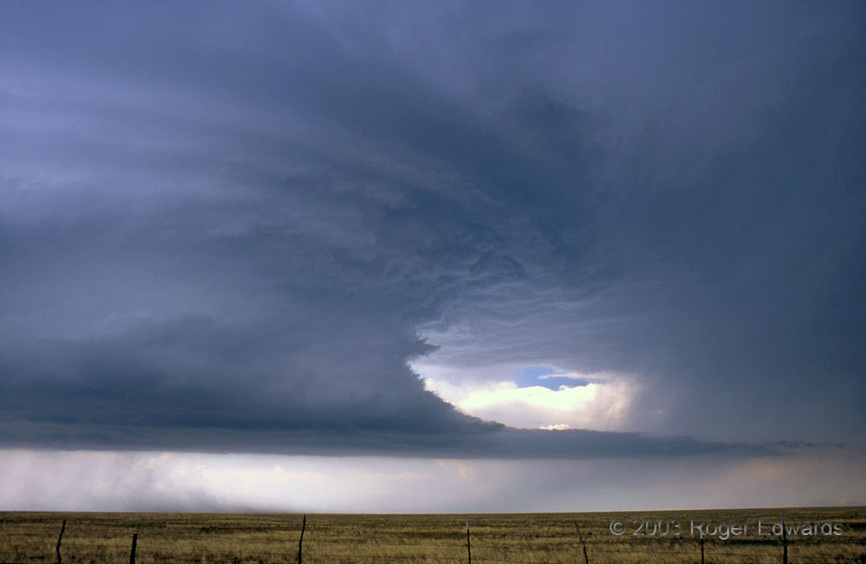
In radar terms, the vault is a region of a supercell downshear from the updraft (usually to the E or NE of the mesocyclone), where large precipitation reflectors like hail arch high over the relatively precip-free inflow air, forming a vaulted reflectivity pattern in cross-section. [Very large and damaging hail sometimes does fall to the ground from there, however!] This is a clean view directly into that part of the storm—we can call it the “visual vault”—with the rotating updraft tower at left, the tail cloud below and the forward-flank precip area at right. Seldom is there such a striking example! The storm was more than a great specimen; it also formed a sky sculpture of inspiring beauty for a long time. It moved toward the south-southeast, conveniently parallel to and (at times) right atop one of the few paved roads in this part of New Mexico. The wide but harmless area of dust under the east part of the updraft was kicked up by outflow from the forward-flank core.
3 NNW Roy NM (3 Jun 3) Looking NNE
35.9845, -104.219