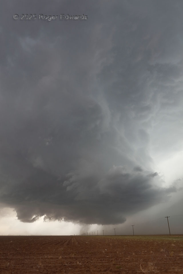
My final view of this supercell was a mighty fine one, with distance revealing a tall, nearly vertical updraft tower above the main updraft base. That erectness in the face of favorable shear for tilted storms indicates strong instability and buoyancy. Most often on the High Plains, one can see the structure of the clouds above the vault region. When that reveals a tall wall of cloud on the north side (not to be confused with the “wall cloud” below!), that is one of my favorite views of a supercell. Why on Earth would I leave a storm that looked like this, and already produced a few tornadoes? I didn’t want to, but had to be back in Norman by about 11 pm, in order to get to bed and get enough sleep to safely drive a tour the next day. The storm already had lasted 4 hours, but had been nontornadic for the last 1-1/2 of those through at least 3 full mesocyclone cycles, and was drifting southeast into a slightly less-favorable environment. That made the decision to go difficult but tolerable. It produced no more tornadoes, but had turned east then north, and still was going just north of Lubbock when I got home!
6 NNE Smyer TX (25 Apr 25) Looking W
33.6743, -102.1226