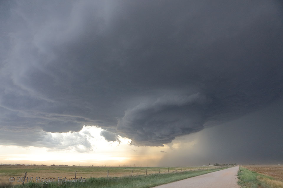
 After producing baseball-sized hail near Four Way, a few other wall clouds and even funnels, this marvelous, high-based supercell turned almost due southward across the High Plains of the Panhandle, in a defiantly rightward display of deviant motion. Here it moved directly over the east side of Amarillo, whose downtown can be seen at distant middle left of this wide-angle view, producing hail over two inches in diameter in some locales. We were located in the rural southeast side of the city. The wall cloud, thanks to the light on its collar, sharply stood out from the broader updraft base spreading nearly overhead. Both inflow and outflow gathered up loads of dust, which accumulated in the convergence zone bordering the forward-flank gust front at right. The memorable storm soon would expand and become outflow-dominant, producing severe, damaging gusts in the Lake Tanglewood area to the south around sunset.
Amarillo TX (8 Jun 17) Looking NNW
35.1254, -101.76
After producing baseball-sized hail near Four Way, a few other wall clouds and even funnels, this marvelous, high-based supercell turned almost due southward across the High Plains of the Panhandle, in a defiantly rightward display of deviant motion. Here it moved directly over the east side of Amarillo, whose downtown can be seen at distant middle left of this wide-angle view, producing hail over two inches in diameter in some locales. We were located in the rural southeast side of the city. The wall cloud, thanks to the light on its collar, sharply stood out from the broader updraft base spreading nearly overhead. Both inflow and outflow gathered up loads of dust, which accumulated in the convergence zone bordering the forward-flank gust front at right. The memorable storm soon would expand and become outflow-dominant, producing severe, damaging gusts in the Lake Tanglewood area to the south around sunset.
Amarillo TX (8 Jun 17) Looking NNW
35.1254, -101.76Updraft Base, Amarillo Hailer
 After producing baseball-sized hail near Four Way, a few other wall clouds and even funnels, this marvelous, high-based supercell turned almost due southward across the High Plains of the Panhandle, in a defiantly rightward display of deviant motion. Here it moved directly over the east side of Amarillo, whose downtown can be seen at distant middle left of this wide-angle view, producing hail over two inches in diameter in some locales. We were located in the rural southeast side of the city. The wall cloud, thanks to the light on its collar, sharply stood out from the broader updraft base spreading nearly overhead. Both inflow and outflow gathered up loads of dust, which accumulated in the convergence zone bordering the forward-flank gust front at right. The memorable storm soon would expand and become outflow-dominant, producing severe, damaging gusts in the Lake Tanglewood area to the south around sunset.
Amarillo TX (8 Jun 17) Looking NNW
35.1254, -101.76