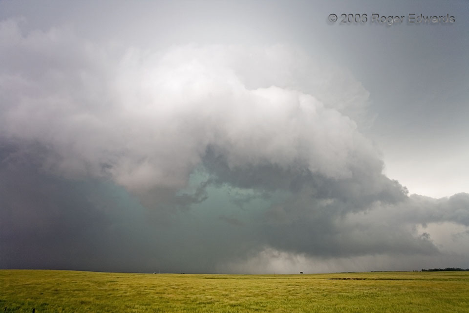
 To create this effect in thunderstorms, sunlight refracts through tens of thousands of feet of rain, hail and wet convective cloud mass, filtering out reds and leaving greens and blues. The green hues preferentially exit areas of heavy precipitation with large drops and hailstones. Aside from the potentially flooding rainfall and damaging hail, this core developed inside a rapidly rotating, recently tornadic mesocyclone of a supercell that already was heavy precip (HP) in character. Inexperienced, unaware or confused drivers caught under such a dense, low-visibility core could meet even more treacherous circumstances in a hurry. The storm was moving toward the southeast, or from far-right to near-left across the view. Unlike most supercells with such “hard right” motion, this one had almost no forward-flank core at ground level to the northeast or east (or anywhere, for that matter). Instead, most of the precipitation was in the mesocyclone! This peculiar storm structure was the supercell’s death sentence; it ingested too much of its own cold outflow and dissipated soon thereafter.
5 SE Forestburg SD (5 Jun 6) Looking WSW
43.9662, -98.0312
To create this effect in thunderstorms, sunlight refracts through tens of thousands of feet of rain, hail and wet convective cloud mass, filtering out reds and leaving greens and blues. The green hues preferentially exit areas of heavy precipitation with large drops and hailstones. Aside from the potentially flooding rainfall and damaging hail, this core developed inside a rapidly rotating, recently tornadic mesocyclone of a supercell that already was heavy precip (HP) in character. Inexperienced, unaware or confused drivers caught under such a dense, low-visibility core could meet even more treacherous circumstances in a hurry. The storm was moving toward the southeast, or from far-right to near-left across the view. Unlike most supercells with such “hard right” motion, this one had almost no forward-flank core at ground level to the northeast or east (or anywhere, for that matter). Instead, most of the precipitation was in the mesocyclone! This peculiar storm structure was the supercell’s death sentence; it ingested too much of its own cold outflow and dissipated soon thereafter.
5 SE Forestburg SD (5 Jun 6) Looking WSW
43.9662, -98.0312Turquoise Core
 To create this effect in thunderstorms, sunlight refracts through tens of thousands of feet of rain, hail and wet convective cloud mass, filtering out reds and leaving greens and blues. The green hues preferentially exit areas of heavy precipitation with large drops and hailstones. Aside from the potentially flooding rainfall and damaging hail, this core developed inside a rapidly rotating, recently tornadic mesocyclone of a supercell that already was heavy precip (HP) in character. Inexperienced, unaware or confused drivers caught under such a dense, low-visibility core could meet even more treacherous circumstances in a hurry. The storm was moving toward the southeast, or from far-right to near-left across the view. Unlike most supercells with such “hard right” motion, this one had almost no forward-flank core at ground level to the northeast or east (or anywhere, for that matter). Instead, most of the precipitation was in the mesocyclone! This peculiar storm structure was the supercell’s death sentence; it ingested too much of its own cold outflow and dissipated soon thereafter.
5 SE Forestburg SD (5 Jun 6) Looking WSW
43.9662, -98.0312