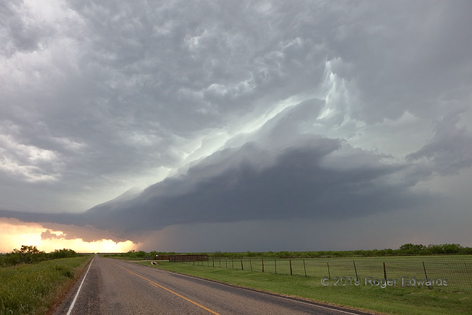
 Supercells over the Great Plains can assume some bizarre and magnificent cloud configurations, and this approximate right triangle was one of the oddest yet. The storm still had a robust, if narrow, surface-based inflow region, manifest as a ragged updraft base, somewhat expanded from just 10–15 minutes before, with a tail cloud on the left (southeast) side. That updraft rotated modestly, as the eye could see, and also was strongly tilted to the north-northeast, along the left arm of the triangle, and above and beyond the large low-level core. The cloud base represents the hypotenuse (long side) in two dimensions. Some wild and chaotic airflows obviously were at play above and around the top tip of the triangle! Soon the triangular updraft area would expand and grow “wings”!
8 WSW Flomot TX (15 Jun 19) Looking SW
34.1742, -101.1231
Supercells over the Great Plains can assume some bizarre and magnificent cloud configurations, and this approximate right triangle was one of the oddest yet. The storm still had a robust, if narrow, surface-based inflow region, manifest as a ragged updraft base, somewhat expanded from just 10–15 minutes before, with a tail cloud on the left (southeast) side. That updraft rotated modestly, as the eye could see, and also was strongly tilted to the north-northeast, along the left arm of the triangle, and above and beyond the large low-level core. The cloud base represents the hypotenuse (long side) in two dimensions. Some wild and chaotic airflows obviously were at play above and around the top tip of the triangle! Soon the triangular updraft area would expand and grow “wings”!
8 WSW Flomot TX (15 Jun 19) Looking SW
34.1742, -101.1231Triangular Supercell
 Supercells over the Great Plains can assume some bizarre and magnificent cloud configurations, and this approximate right triangle was one of the oddest yet. The storm still had a robust, if narrow, surface-based inflow region, manifest as a ragged updraft base, somewhat expanded from just 10–15 minutes before, with a tail cloud on the left (southeast) side. That updraft rotated modestly, as the eye could see, and also was strongly tilted to the north-northeast, along the left arm of the triangle, and above and beyond the large low-level core. The cloud base represents the hypotenuse (long side) in two dimensions. Some wild and chaotic airflows obviously were at play above and around the top tip of the triangle! Soon the triangular updraft area would expand and grow “wings”!
8 WSW Flomot TX (15 Jun 19) Looking SW
34.1742, -101.1231