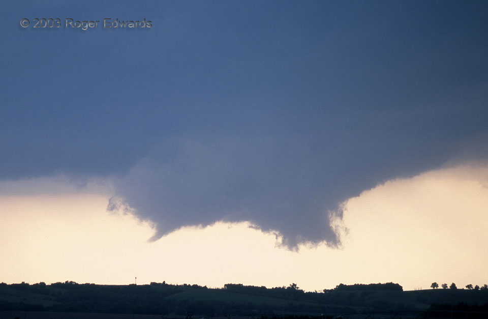
 During the forenoon hours, we had forecast this area for best supercell and tornado potential, doubtful about reaching it in time from our Denver-area base. I’m glad we tried! As Elke and I gulped a quick meal along I-80, ignoring unsolicited advice from a very respected and experienced storm-observing colleague urging us to go south, we saw the storm erupt to our north, then arrived on site with just a few moments to spare. Awaiting us was a classical and beautiful tornadic event, to remember for all time. The storm seemed to be saving its best for our arrival, holding out just long enough to reward us for our triumph of determination over time and distractions. As if on cue, when we set up our tripods, a frantically rotating wall cloud took shape under the young storm’s base. Within just a few minutes more, it developed a funnel (at left). Quite shortly, that funnel became a graceful, slender tornado, firmly but harmlessly planted on the rolling plains of central Nebraska.
10 SSW Sargent NE (9 Jun 3) Looking NW
41.4962, -99.3896
RADAR
During the forenoon hours, we had forecast this area for best supercell and tornado potential, doubtful about reaching it in time from our Denver-area base. I’m glad we tried! As Elke and I gulped a quick meal along I-80, ignoring unsolicited advice from a very respected and experienced storm-observing colleague urging us to go south, we saw the storm erupt to our north, then arrived on site with just a few moments to spare. Awaiting us was a classical and beautiful tornadic event, to remember for all time. The storm seemed to be saving its best for our arrival, holding out just long enough to reward us for our triumph of determination over time and distractions. As if on cue, when we set up our tripods, a frantically rotating wall cloud took shape under the young storm’s base. Within just a few minutes more, it developed a funnel (at left). Quite shortly, that funnel became a graceful, slender tornado, firmly but harmlessly planted on the rolling plains of central Nebraska.
10 SSW Sargent NE (9 Jun 3) Looking NW
41.4962, -99.3896
RADARTornado Imminent!
 During the forenoon hours, we had forecast this area for best supercell and tornado potential, doubtful about reaching it in time from our Denver-area base. I’m glad we tried! As Elke and I gulped a quick meal along I-80, ignoring unsolicited advice from a very respected and experienced storm-observing colleague urging us to go south, we saw the storm erupt to our north, then arrived on site with just a few moments to spare. Awaiting us was a classical and beautiful tornadic event, to remember for all time. The storm seemed to be saving its best for our arrival, holding out just long enough to reward us for our triumph of determination over time and distractions. As if on cue, when we set up our tripods, a frantically rotating wall cloud took shape under the young storm’s base. Within just a few minutes more, it developed a funnel (at left). Quite shortly, that funnel became a graceful, slender tornado, firmly but harmlessly planted on the rolling plains of central Nebraska.
10 SSW Sargent NE (9 Jun 3) Looking NW
41.4962, -99.3896
RADAR