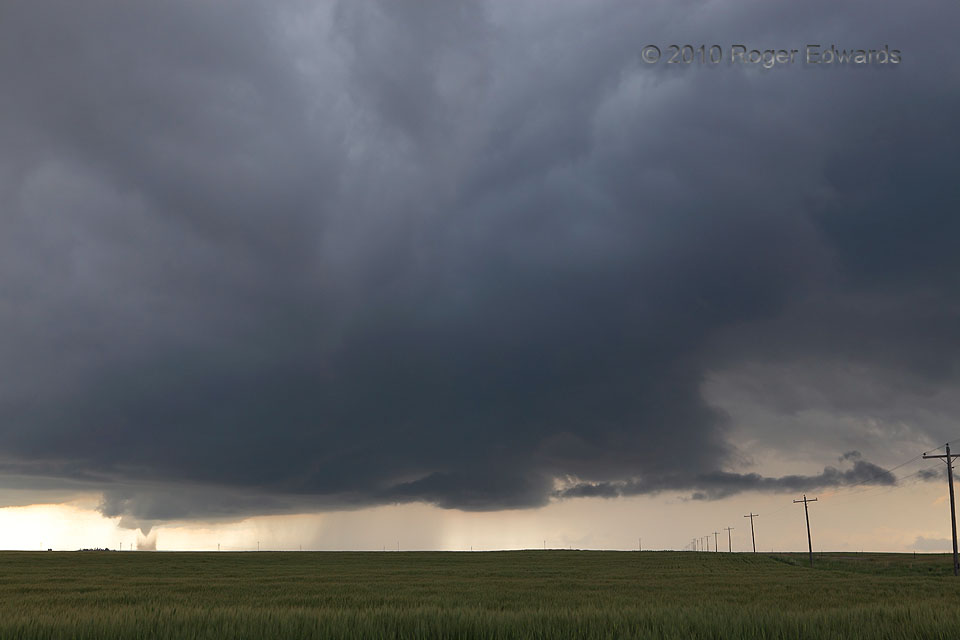
 By this time, the Chugwater tornado clearly was beginning to meet its Chugwaterloo. Though moving toward us in an absolute sense, it had migrated toward the back of the storm in this wide-angle view, while a new (and ultimately non-tornadic) mesocyclone formed in front middle, with a thin, broken tail cloud to its right. The tornado had wrapped so much rear-flank and occlusion-downdraft air that it was getting completely segregated from the original source of warm, moist inflow, and was about to spin down. Meanwhile, unknown to me, large hailstones thousands of feet aloft were beginning to drop right downward toward us. Within a couple minutes, while shooting the tornado’s last gasp, I heard the first big thud in the mud, as a 3-inch hailstone landed about six feet to my right.
12 E Chugwater WY (20 Jun 10) Looking WSW
41.7405, -104.595
RADAR
By this time, the Chugwater tornado clearly was beginning to meet its Chugwaterloo. Though moving toward us in an absolute sense, it had migrated toward the back of the storm in this wide-angle view, while a new (and ultimately non-tornadic) mesocyclone formed in front middle, with a thin, broken tail cloud to its right. The tornado had wrapped so much rear-flank and occlusion-downdraft air that it was getting completely segregated from the original source of warm, moist inflow, and was about to spin down. Meanwhile, unknown to me, large hailstones thousands of feet aloft were beginning to drop right downward toward us. Within a couple minutes, while shooting the tornado’s last gasp, I heard the first big thud in the mud, as a 3-inch hailstone landed about six feet to my right.
12 E Chugwater WY (20 Jun 10) Looking WSW
41.7405, -104.595
RADARTornadic Supercell, Wyoming High Plains
 By this time, the Chugwater tornado clearly was beginning to meet its Chugwaterloo. Though moving toward us in an absolute sense, it had migrated toward the back of the storm in this wide-angle view, while a new (and ultimately non-tornadic) mesocyclone formed in front middle, with a thin, broken tail cloud to its right. The tornado had wrapped so much rear-flank and occlusion-downdraft air that it was getting completely segregated from the original source of warm, moist inflow, and was about to spin down. Meanwhile, unknown to me, large hailstones thousands of feet aloft were beginning to drop right downward toward us. Within a couple minutes, while shooting the tornado’s last gasp, I heard the first big thud in the mud, as a 3-inch hailstone landed about six feet to my right.
12 E Chugwater WY (20 Jun 10) Looking WSW
41.7405, -104.595
RADAR