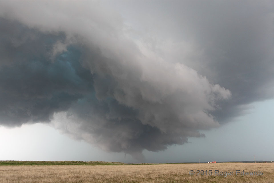
 Following an earlier, high-based stage with long-lived funnel cloud (and possible weak tornado), the Canadian (TX) supercell underwent a nearly suicidal phase where its gust front surged east and almost completely undercut the entire updraft area. Even at this stage, a short-lived, tight mesocyclonic wrap-up on the north rim of that rear-flank downdraft spawned the very short-lived funnel cloud at lower middle, just to the left of a tail cloud. The start of an occlusion-downdraft cut also can be seen in the distant cloud base at left. The storm would re-anchor itself near this position as outflow weakened and intense inflow continued, then would become quite decidedly tornadic.
7 NW Canadian TX (27 May 15) Looking NNE
35.9901, -100.4729
Tornadic Supercell Intermission
 Following an earlier, high-based stage with long-lived funnel cloud (and possible weak tornado), the Canadian (TX) supercell underwent a nearly suicidal phase where its gust front surged east and almost completely undercut the entire updraft area. Even at this stage, a short-lived, tight mesocyclonic wrap-up on the north rim of that rear-flank downdraft spawned the very short-lived funnel cloud at lower middle, just to the left of a tail cloud. The start of an occlusion-downdraft cut also can be seen in the distant cloud base at left. The storm would re-anchor itself near this position as outflow weakened and intense inflow continued, then would become quite decidedly tornadic.
7 NW Canadian TX (27 May 15) Looking NNE
35.9901, -100.4729