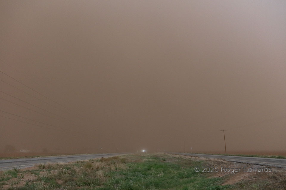
See the spectacular and majestic tornadic supercell that was right down the road and moving toward us? No? Good, because we couldn’t either. The only cloud we could see was the dust cloud, in roaring inflow winds lofting it from nearby dry, plowed fields, akin to a storm-scale Dust Bowl. Based on our sequence of stops and others’ observations, dust was continuous in a plume hundreds of feet thick above ground and ramping on inward to the mesocyclone. All we could do was stay ahead of the dust bomb and hope for an occasional break, which mostly did not happen until the storm stopped producing brief, dusty (of course) spinups, that were either embedded in or just behind this mess. One could penetrate the dust and drive right into a tornado (or the back of a chain-reaction wreck) before realizing it. It’s no fun to inhale, either. Discretion indeed was the better part of valor here — live to chase another day. The same storm earlier had wonderful visual form; we only could assume it still was well-structured…somewhere in there.
5 SE Lamesa TX (29 May 25) Looking NW
32.6727, -101.8805