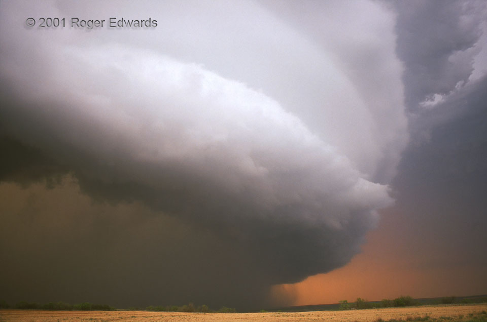
 For ten hours, this legendary thunderstorm lumbered eastward across northwest Texas, extraordinarily long-lived even by supercellular standards. I was fortunate enough to witness it in some manner from just after birth to its demise after midnight. Though it produced a few very brief, small diurnal spin-ups (lame excuses for notches on the guns of a few over-exuberant “chasers”), the “Kress-Turkey” storm was essentially non-tornadic until after dark. No matter: Its imposing size, protracted swath of mayhem, great variations in structure, and otherworldly beauty ensured its place in the lore of storm observation. By this time, the supercell had grown to enormous width and depth, inhaling long streamers of dust from several counties away, and assuming HP (heavy precip) character. The storm dropped hail larger than fists and gushed forth flooding rains within that murky, smoked-glass colored core at lower left. During this widest-angle, sunset-hour view, it was departing the High Plains for the lower elevations and deeper inflow layer east of the Caprock.
9 ESE Silverton TX (29 May 1), Looking NNE
34.4158, -101.1441
For ten hours, this legendary thunderstorm lumbered eastward across northwest Texas, extraordinarily long-lived even by supercellular standards. I was fortunate enough to witness it in some manner from just after birth to its demise after midnight. Though it produced a few very brief, small diurnal spin-ups (lame excuses for notches on the guns of a few over-exuberant “chasers”), the “Kress-Turkey” storm was essentially non-tornadic until after dark. No matter: Its imposing size, protracted swath of mayhem, great variations in structure, and otherworldly beauty ensured its place in the lore of storm observation. By this time, the supercell had grown to enormous width and depth, inhaling long streamers of dust from several counties away, and assuming HP (heavy precip) character. The storm dropped hail larger than fists and gushed forth flooding rains within that murky, smoked-glass colored core at lower left. During this widest-angle, sunset-hour view, it was departing the High Plains for the lower elevations and deeper inflow layer east of the Caprock.
9 ESE Silverton TX (29 May 1), Looking NNE
34.4158, -101.1441Texas-Sized HP
 For ten hours, this legendary thunderstorm lumbered eastward across northwest Texas, extraordinarily long-lived even by supercellular standards. I was fortunate enough to witness it in some manner from just after birth to its demise after midnight. Though it produced a few very brief, small diurnal spin-ups (lame excuses for notches on the guns of a few over-exuberant “chasers”), the “Kress-Turkey” storm was essentially non-tornadic until after dark. No matter: Its imposing size, protracted swath of mayhem, great variations in structure, and otherworldly beauty ensured its place in the lore of storm observation. By this time, the supercell had grown to enormous width and depth, inhaling long streamers of dust from several counties away, and assuming HP (heavy precip) character. The storm dropped hail larger than fists and gushed forth flooding rains within that murky, smoked-glass colored core at lower left. During this widest-angle, sunset-hour view, it was departing the High Plains for the lower elevations and deeper inflow layer east of the Caprock.
9 ESE Silverton TX (29 May 1), Looking NNE
34.4158, -101.1441