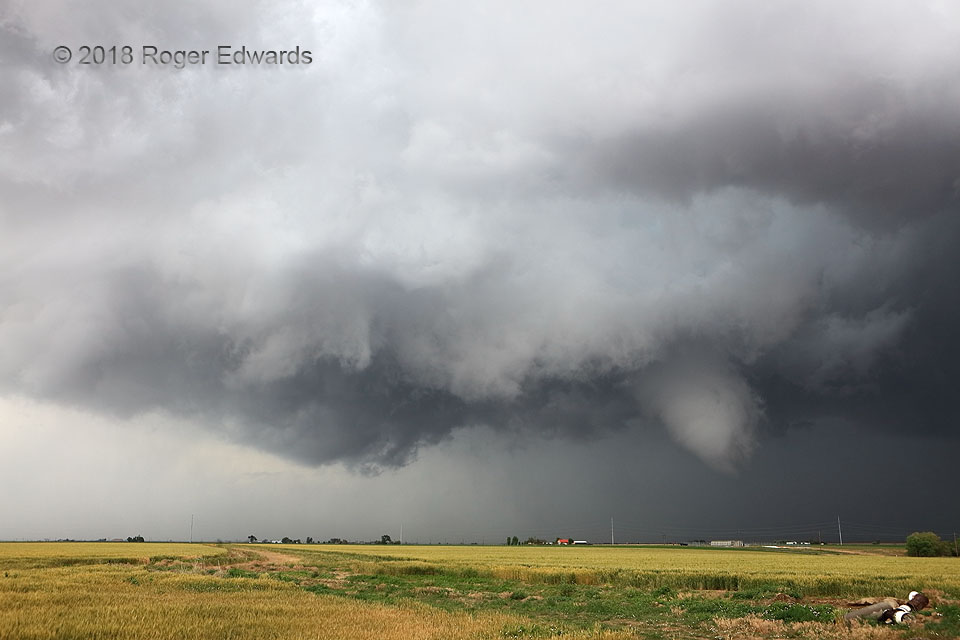
 Closing in on this cyclic supercell from the south, I had noticed each new mesocyclonic wrap-up render a lower cloud base, as the storm moved into greater moisture from both the environment and its own outflow. While a newer mesocyclone began to the east, I stayed here to witness whatever would happen with a gradually and very suspiciously tightening area of rotation in this “bent-back” mesocyclone’s wall cloud. In short order, the ragged, bulbous lowering at right began turning especially tightly, obviously tilted by some outflow, and was just beginning to develop a tornadic ground circulation as I shot this photo. The tornado indeed would stretch southeastward in a slowly evolving but absolutely spectacular display!
4 S Prospect Valley CO (19 Jun 18) Looking NNE
40.0152, -104.4178
RADAR
Closing in on this cyclic supercell from the south, I had noticed each new mesocyclonic wrap-up render a lower cloud base, as the storm moved into greater moisture from both the environment and its own outflow. While a newer mesocyclone began to the east, I stayed here to witness whatever would happen with a gradually and very suspiciously tightening area of rotation in this “bent-back” mesocyclone’s wall cloud. In short order, the ragged, bulbous lowering at right began turning especially tightly, obviously tilted by some outflow, and was just beginning to develop a tornadic ground circulation as I shot this photo. The tornado indeed would stretch southeastward in a slowly evolving but absolutely spectacular display!
4 S Prospect Valley CO (19 Jun 18) Looking NNE
40.0152, -104.4178
RADARSuspicions
 Closing in on this cyclic supercell from the south, I had noticed each new mesocyclonic wrap-up render a lower cloud base, as the storm moved into greater moisture from both the environment and its own outflow. While a newer mesocyclone began to the east, I stayed here to witness whatever would happen with a gradually and very suspiciously tightening area of rotation in this “bent-back” mesocyclone’s wall cloud. In short order, the ragged, bulbous lowering at right began turning especially tightly, obviously tilted by some outflow, and was just beginning to develop a tornadic ground circulation as I shot this photo. The tornado indeed would stretch southeastward in a slowly evolving but absolutely spectacular display!
4 S Prospect Valley CO (19 Jun 18) Looking NNE
40.0152, -104.4178
RADAR