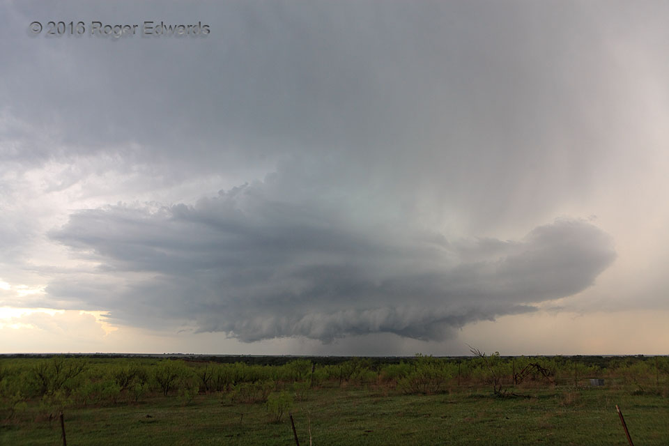
 Every year of storm observing, I see amazing new things in the sky, despite hundreds and hundreds of supercells experienced over the decades. The atmosphere almost always succeeds in teaching a fresh lesson and offering a novel experience. On this day, a big, messy multicell briefly became a supercell, then lost the mesocyclone and enlarged into an even more swollen, clustered mess. From that chaotic blob arose yet another supercell phase, which soon demolished its low-level structure with cold outflow. The midlevel mesocyclone somehow lingered, however, and when it whiffed low-level inflow again: BOOM. Rising like a phoenix from the ashes of outflow dominance, this storm again started spinning through a deep layer, constructing wilder cloud forms than ever. Though never tornadic, this storm provided hours of thoroughly fascinating evolution, sometimes in beautiful ways.
7 WNW Walters OK (10 Apr 16) Looking WSW
34.3764, -98.4351
Every year of storm observing, I see amazing new things in the sky, despite hundreds and hundreds of supercells experienced over the decades. The atmosphere almost always succeeds in teaching a fresh lesson and offering a novel experience. On this day, a big, messy multicell briefly became a supercell, then lost the mesocyclone and enlarged into an even more swollen, clustered mess. From that chaotic blob arose yet another supercell phase, which soon demolished its low-level structure with cold outflow. The midlevel mesocyclone somehow lingered, however, and when it whiffed low-level inflow again: BOOM. Rising like a phoenix from the ashes of outflow dominance, this storm again started spinning through a deep layer, constructing wilder cloud forms than ever. Though never tornadic, this storm provided hours of thoroughly fascinating evolution, sometimes in beautiful ways.
7 WNW Walters OK (10 Apr 16) Looking WSW
34.3764, -98.4351Supercellular Resurrection
 Every year of storm observing, I see amazing new things in the sky, despite hundreds and hundreds of supercells experienced over the decades. The atmosphere almost always succeeds in teaching a fresh lesson and offering a novel experience. On this day, a big, messy multicell briefly became a supercell, then lost the mesocyclone and enlarged into an even more swollen, clustered mess. From that chaotic blob arose yet another supercell phase, which soon demolished its low-level structure with cold outflow. The midlevel mesocyclone somehow lingered, however, and when it whiffed low-level inflow again: BOOM. Rising like a phoenix from the ashes of outflow dominance, this storm again started spinning through a deep layer, constructing wilder cloud forms than ever. Though never tornadic, this storm provided hours of thoroughly fascinating evolution, sometimes in beautiful ways.
7 WNW Walters OK (10 Apr 16) Looking WSW
34.3764, -98.4351