[Click Image to Enlarge]
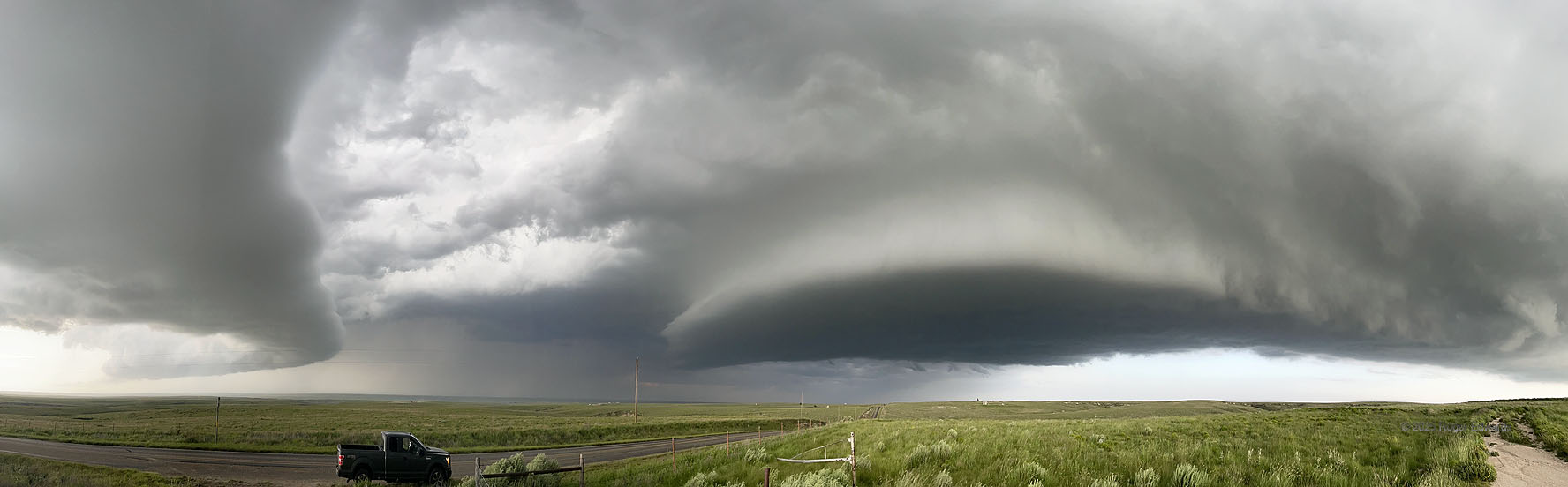
What a weird sky! Only a panoramic view could capture visually what was happening here. Even the nearest (Amarillo) radar, which scanned into the lower midlevels of this process, didn’t represent it well, smudging these two supercells together aloft. The dying supercell at left spent most, maybe all, of its life cycle as an elevated storm, dating from its origins in the middle of the Oklahoma Panhandle. Here it surges southeastward toward the newer storm at middle and right, the older storm’s mesocyclone being choked off north of a big horseshoe base carved out by the rear-flank downdraft. Yet its outflow would combine with the growing core of the young storm to send it on a southeastward ride, despite the latter’s being surface-based. I had been staying abeam of the older supercell when this big, dark, deep updraft area materialized in minutes and grew fast to my east, in a high-instability environment favorable for explosive storm growth. After this pano, it was time to get southeast fast before this started dropping giant hail! Radar loops made it looklike it was on storm charging southeastward the whole time, but this image reveals quite the contrary.
8 WSW Lipscomb TX (17 Jun 25) Looking NNW-NE-SSE
36.2018, -100.4168