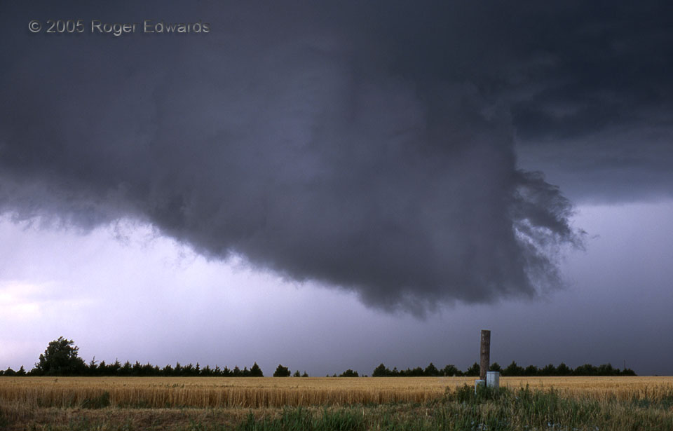
 We had been tracking a rather scruffy and marginally organized supercell for about an hour—a storm that had gone through one short lived mesocyclone and high based wall cloud of little consequence. We knew it was moving toward a very moist and favorably sheared outflow boundary left over from the previous day’s storms, so we stayed with it. In the time span of driving north just a few miles (less than five minutes), the base suddenly lowered in dramatic fashion. The scuddy cloud tendrils seen off the bottom right (NE) edge of the wall cloud raced upward and leftward at astonishing velocity. The storm had “struck water” along the juicy old boundary! This broad, very low hanging and rapidly rotating wall cloud then appeared in less than a minute where no cloud material at all existed before. Meanwhile an eardrum-bashing barrage of nearby lightning strikes kept my photography confined to behind a barely-open car window. Though it didn’t yield a tornado, the wall cloud shown here would be the second of seven separate, visible occlusion circulations with this storm. The next also was photogenic and well-defined…
5 ENE Kaffir TX (11 Jun 5) Looking NW
34.6466, -101.741
We had been tracking a rather scruffy and marginally organized supercell for about an hour—a storm that had gone through one short lived mesocyclone and high based wall cloud of little consequence. We knew it was moving toward a very moist and favorably sheared outflow boundary left over from the previous day’s storms, so we stayed with it. In the time span of driving north just a few miles (less than five minutes), the base suddenly lowered in dramatic fashion. The scuddy cloud tendrils seen off the bottom right (NE) edge of the wall cloud raced upward and leftward at astonishing velocity. The storm had “struck water” along the juicy old boundary! This broad, very low hanging and rapidly rotating wall cloud then appeared in less than a minute where no cloud material at all existed before. Meanwhile an eardrum-bashing barrage of nearby lightning strikes kept my photography confined to behind a barely-open car window. Though it didn’t yield a tornado, the wall cloud shown here would be the second of seven separate, visible occlusion circulations with this storm. The next also was photogenic and well-defined…
5 ENE Kaffir TX (11 Jun 5) Looking NW
34.6466, -101.741Sudden Appearances
 We had been tracking a rather scruffy and marginally organized supercell for about an hour—a storm that had gone through one short lived mesocyclone and high based wall cloud of little consequence. We knew it was moving toward a very moist and favorably sheared outflow boundary left over from the previous day’s storms, so we stayed with it. In the time span of driving north just a few miles (less than five minutes), the base suddenly lowered in dramatic fashion. The scuddy cloud tendrils seen off the bottom right (NE) edge of the wall cloud raced upward and leftward at astonishing velocity. The storm had “struck water” along the juicy old boundary! This broad, very low hanging and rapidly rotating wall cloud then appeared in less than a minute where no cloud material at all existed before. Meanwhile an eardrum-bashing barrage of nearby lightning strikes kept my photography confined to behind a barely-open car window. Though it didn’t yield a tornado, the wall cloud shown here would be the second of seven separate, visible occlusion circulations with this storm. The next also was photogenic and well-defined…
5 ENE Kaffir TX (11 Jun 5) Looking NW
34.6466, -101.741