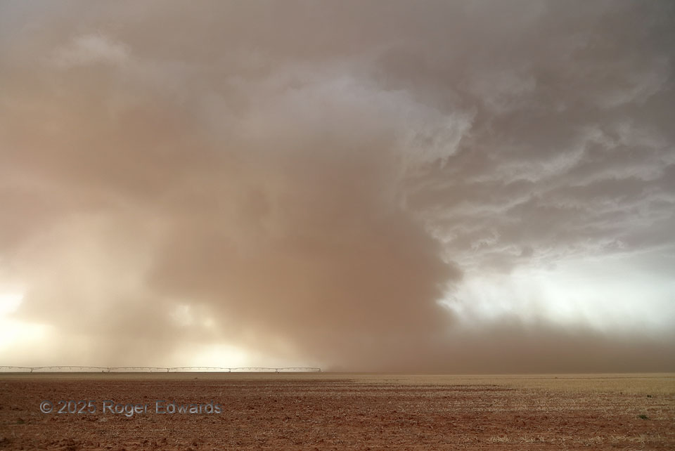
Fighting only partly modified cold outflow from an earlier supercell to the east, yet benefiting from it in terms of enhanced vorticity, this storm already had spun up one strong wall cloud and a few brief tornadoes. However, I suspect that the coolness of the other storm’s outflow (which I could feel by this point) kept this one from producing more sustained and/or bigger tornadoes. Is this a tornado? No! It is a combined feed of outflow dust from the environmental mesoscale cold pool and the storm’s own forward flank, drawn up and into a slowly rotating wall cloud, and mostly obscuring its base. It’s visually obvious that this storm still was surface-based, since dust was rising into the storm from the surface. Had this contained a tornado, it would have been extremely difficult to see. Since the mesocyclone was about a mile away, and moving my way, I got out of its way. Though the odds were against any more tornadoes with this storm, obscured visibility wasn’t something in which I wanted to gamble a final spin-up overhead. I would end up following this supercell to near the edge of the Caprock for twilight eye candy of the electrical kind.
5 SW New Home TX (6 Jun 25) Looking WNW
33.2834, -101.9812