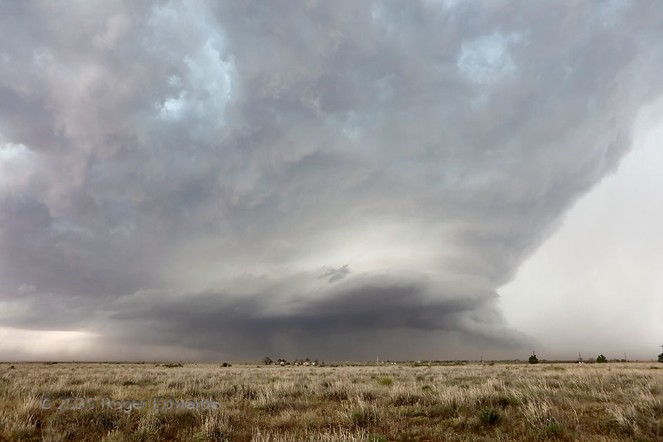
Normally, being east of a southeastward-moving, heavy-precipitation (HP) supercell is a lousy idea, both meteorologically and tactically. They tend to curl the forward-flank precip region (which can contain damaging hail and flooding rains) eastward then southeastward, rendering this view of the main updraft region at this distance nearly impossible, and our storm-relative position decidedly unsafe. Yet on this day, we caught the storm early in its life cycle, before that downshear core had a chance to develop fully. However, it was developing, and we bailed south soon, while rain increased, lightning drew closer, and near-severe hail started to fall. This would be our last good view of the supercell until it blew itself upscale with outflow north of Big Spring; most of the journey from here to there involved far too much dust.
8 E Brownfield TX (29 May 25) Looking W
33.1791, -102.1361