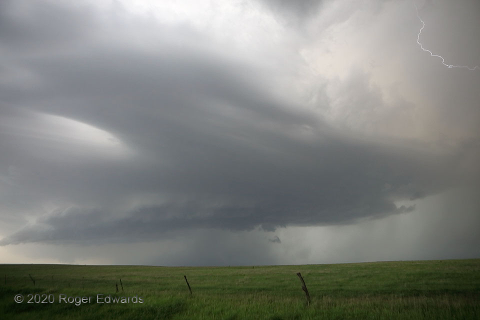
 One in a series of mostly weak, poorly structured supercells embedded in a convective line, this storm sported a wild, laminar, somewhat chevron-shaped cloud deck above the main convective updraft area. The odd cloud form reminded me loosely of a storm I had seen near the Texas Caprock the year before that looked like a winged alien spacecraft. I was fortunate to catch one of the storm’s numerous flickers of “vault” lightning during this near-peak level of its organization, before the cell became more outflow-dominant to my north. The next supercell’s updraft base and wall cloud can be seen through the haze to the distant southwest, at left rear, and I would have to jump east several miles to stay out of its direct path for good observation. I traveled back and forth along SD-34 for nearly three hours, picking off one after another of these supercells as they rolled up the belt from an anchoring genesis area southwest of Kennebec.
18 SSE Blunt SD (7 Jun 20) Looking WSW
44.2727, -99.8459
One in a series of mostly weak, poorly structured supercells embedded in a convective line, this storm sported a wild, laminar, somewhat chevron-shaped cloud deck above the main convective updraft area. The odd cloud form reminded me loosely of a storm I had seen near the Texas Caprock the year before that looked like a winged alien spacecraft. I was fortunate to catch one of the storm’s numerous flickers of “vault” lightning during this near-peak level of its organization, before the cell became more outflow-dominant to my north. The next supercell’s updraft base and wall cloud can be seen through the haze to the distant southwest, at left rear, and I would have to jump east several miles to stay out of its direct path for good observation. I traveled back and forth along SD-34 for nearly three hours, picking off one after another of these supercells as they rolled up the belt from an anchoring genesis area southwest of Kennebec.
18 SSE Blunt SD (7 Jun 20) Looking WSW
44.2727, -99.8459Strange Supercell Sky
 One in a series of mostly weak, poorly structured supercells embedded in a convective line, this storm sported a wild, laminar, somewhat chevron-shaped cloud deck above the main convective updraft area. The odd cloud form reminded me loosely of a storm I had seen near the Texas Caprock the year before that looked like a winged alien spacecraft. I was fortunate to catch one of the storm’s numerous flickers of “vault” lightning during this near-peak level of its organization, before the cell became more outflow-dominant to my north. The next supercell’s updraft base and wall cloud can be seen through the haze to the distant southwest, at left rear, and I would have to jump east several miles to stay out of its direct path for good observation. I traveled back and forth along SD-34 for nearly three hours, picking off one after another of these supercells as they rolled up the belt from an anchoring genesis area southwest of Kennebec.
18 SSE Blunt SD (7 Jun 20) Looking WSW
44.2727, -99.8459