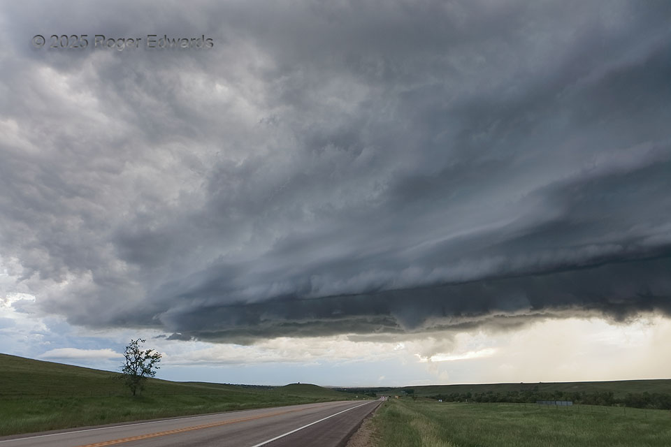
Don’t get fixated on the mesocyclone region, even if it is worth intense attention as this storm’s was, and ignore strikingly beautiful formations in other directions! Fortunately that advice is a little easier to follow when the other spectacular part of the storm is directly connected. This sharply layered, tiered arcus extended southwestward as part of the rear-flank downdraft, making a stunning outflow scene even as the main part of the supercell thundered along to the northeast.
4 NW St. Onge SD (11 Jun 22) Looking NE
44.5938, -103.7693