SkyPix

A digital photographic storybook of clouds, weather and water by Roger Edwards.

  • Home
  • Newest Posts
  • Galleries
    • Aerial
    • All Hail
    • Burnscapes
    • Daytime Lightning
    • Floods
    • Fog and Mist
    • Gallery of Outflow
    • Hurricane Andrew
    • Mini Cloud Atlas
    • Night Lightning
    • Mostly Okie Winters
    • Sunsets and Sunrises
    • The Majestic Supercell
    • Tornadoes
    • Unusual Weather Damage
    • Visual Effects
    • Wall Cloud Wall
    • Water Works
  • About
  • F.A.Q.
  • Contact

Sock Wall

2023-02-17 By Roger Edwards

Sock Wall

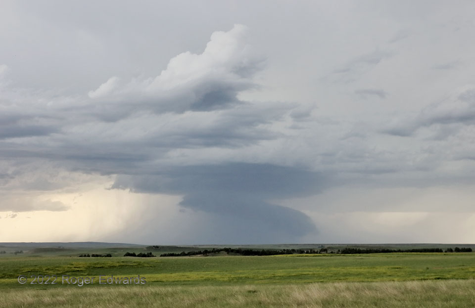
The first I encountered in a chain of western South Dakota supercells, and positionally the third up from the back (south) end, passed by in increasingly rain-wrapped and high-based form.  Its wall cloud elongated into a socked-foot shape before the storm moved north-northeast up the line and lose definition.  The wall cloud had been more blocky and higher, but as precip increased all around, it grew lower.  How does this happen?  Two ways, the second more influential here:  1) lowering pressure, which lowers condensation level, and 2) cooling of inflow air, in this case by rain.  The latter also helped the wall cloud elongate in sock-like form, toward the forward-flank core region.  When supercell bases get lower, what’s really happening is some combination of both of those factors, while the air into wall clouds is rising.   The same concept, with faster rising motion, explains why tornadoes appear to “touch down” but really don’t in a physical sense.  This supercell never came close to being tornadic.  I stayed at this location for a bit to watch the next supercell approach as well.

8 NE Provo SD (13 Jun 22) Looking WNW
43.2454, -103.7006

Filed Under: Wall Cloud Wall Tagged With: clouds, convection, Great Plains, landscapes, Provo, South Dakota, storms, supercells, thunderstorms, wall clouds, weather

Previous: Sunrise Leaving the Land of Enchantment
Next: Another 22-Degree Halo

About

Welcome to SkyPix, an online photo book of clouds, weather and water by Roger Edwards. As in a printed coffee-table book, every image has its own page with a unique story. After all, meaningful photography is much more than just picture-taking; it is visually rendering a moment in place and time from a perspective like none other. As a scientist and an artist, I hope my deep passion for the power and splendor of our skies and waters shines through in these pages. If you are a cloud and weather aficionado, outdoor enthusiast, outdoor or nature photographer, art lover, or anyone who craves learning, enjoy...

More

Further images from this photographer may be found at:
Roger Edwards Image of the Week
Roger Edwards Digital Galleries
Storms Observed Chase BLOG

Copyright © 2025 ROGER EDWARDS SKYPIX.PHOTOGRAPHY ALL RIGHTS RESERVED. · Design by INSOJOURN Design and Images · WordPress · Log in