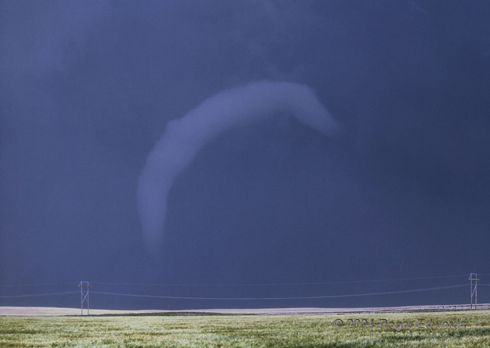
 In a final encore, a tornado emerges from the rain one last time and stretches out, its condensation funnel taking on the shape of a worm against the slate-blue background of the supercell’s precipitation area. This tornado began in Nebraska, within less than two miles of the Colorado border. Initially a tall, thin, dusty tube (that stage not shown because of driving for position and poor photography conditions for slide film), it moved generally northeastward across rural eastern Deuel County. During its 38-minute lifespan, the tornado orbited an initially separate wall cloud, became embedded within the wall cloud, wrapped in rain twice, re-emerged twice, and evolved through a fascinating variety of shapes and forms. Because it hid from view of observers for at least two short intervals, some advertised this as multiple tornadoes, perhaps to add “notches to the gun” of their personal tornado counts. Instead, and without hesitation, I clearly judged this to be one long-lived tornado, because of the continuity in space, time and process through its rain-wrapped stages.
4 N Big Springs NE (10 Jun 4) Looking N
41.1126, -102.075
RADAR
In a final encore, a tornado emerges from the rain one last time and stretches out, its condensation funnel taking on the shape of a worm against the slate-blue background of the supercell’s precipitation area. This tornado began in Nebraska, within less than two miles of the Colorado border. Initially a tall, thin, dusty tube (that stage not shown because of driving for position and poor photography conditions for slide film), it moved generally northeastward across rural eastern Deuel County. During its 38-minute lifespan, the tornado orbited an initially separate wall cloud, became embedded within the wall cloud, wrapped in rain twice, re-emerged twice, and evolved through a fascinating variety of shapes and forms. Because it hid from view of observers for at least two short intervals, some advertised this as multiple tornadoes, perhaps to add “notches to the gun” of their personal tornado counts. Instead, and without hesitation, I clearly judged this to be one long-lived tornado, because of the continuity in space, time and process through its rain-wrapped stages.
4 N Big Springs NE (10 Jun 4) Looking N
41.1126, -102.075
RADARSky Worm
 In a final encore, a tornado emerges from the rain one last time and stretches out, its condensation funnel taking on the shape of a worm against the slate-blue background of the supercell’s precipitation area. This tornado began in Nebraska, within less than two miles of the Colorado border. Initially a tall, thin, dusty tube (that stage not shown because of driving for position and poor photography conditions for slide film), it moved generally northeastward across rural eastern Deuel County. During its 38-minute lifespan, the tornado orbited an initially separate wall cloud, became embedded within the wall cloud, wrapped in rain twice, re-emerged twice, and evolved through a fascinating variety of shapes and forms. Because it hid from view of observers for at least two short intervals, some advertised this as multiple tornadoes, perhaps to add “notches to the gun” of their personal tornado counts. Instead, and without hesitation, I clearly judged this to be one long-lived tornado, because of the continuity in space, time and process through its rain-wrapped stages.
4 N Big Springs NE (10 Jun 4) Looking N
41.1126, -102.075
RADAR