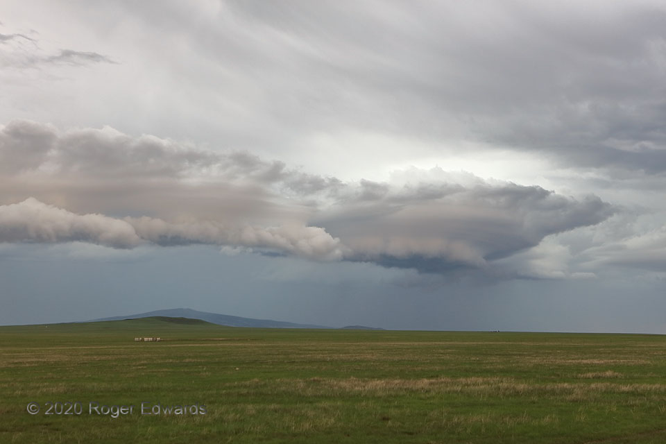
 A weirdly shaped and colored shelf cloud surged out across the volcano-studded High Plains of northeastern New Mexico, heralding a rush of cooler air and rain across this shortgrass rangeland. The combination of laminar, spaceship-like cloud-base formations and an odd beige tint with hints of pale mauve is uncommon in my storm-observing experience, but for similar sightings the very day before, and in the same general area. That leads me to believe that something about the seasonal land cover in the area combines with extensive, thick, convectively generated cloud cover, in late afternoon, and an open sky in the distant east, to yield this cloud tint. Sierra Grande, an extinct shield volcano in the distance at left, offers the highest point in the U.S. east of the Rocky Mountains, at 8,723 feet above sea level. These storms didn’t form on Sierra Grande; instead they rolled over the peak from their initiation area in the Sangre de Cristos near Raton, north of the area where I had been observing mountain storms in early afternoon.
5 SSW Grenville NM (3 Aug 20) Looking NW
36.5288, -103.6494
A weirdly shaped and colored shelf cloud surged out across the volcano-studded High Plains of northeastern New Mexico, heralding a rush of cooler air and rain across this shortgrass rangeland. The combination of laminar, spaceship-like cloud-base formations and an odd beige tint with hints of pale mauve is uncommon in my storm-observing experience, but for similar sightings the very day before, and in the same general area. That leads me to believe that something about the seasonal land cover in the area combines with extensive, thick, convectively generated cloud cover, in late afternoon, and an open sky in the distant east, to yield this cloud tint. Sierra Grande, an extinct shield volcano in the distance at left, offers the highest point in the U.S. east of the Rocky Mountains, at 8,723 feet above sea level. These storms didn’t form on Sierra Grande; instead they rolled over the peak from their initiation area in the Sangre de Cristos near Raton, north of the area where I had been observing mountain storms in early afternoon.
5 SSW Grenville NM (3 Aug 20) Looking NW
36.5288, -103.6494Sierra Grande Shelf Cloud
 A weirdly shaped and colored shelf cloud surged out across the volcano-studded High Plains of northeastern New Mexico, heralding a rush of cooler air and rain across this shortgrass rangeland. The combination of laminar, spaceship-like cloud-base formations and an odd beige tint with hints of pale mauve is uncommon in my storm-observing experience, but for similar sightings the very day before, and in the same general area. That leads me to believe that something about the seasonal land cover in the area combines with extensive, thick, convectively generated cloud cover, in late afternoon, and an open sky in the distant east, to yield this cloud tint. Sierra Grande, an extinct shield volcano in the distance at left, offers the highest point in the U.S. east of the Rocky Mountains, at 8,723 feet above sea level. These storms didn’t form on Sierra Grande; instead they rolled over the peak from their initiation area in the Sangre de Cristos near Raton, north of the area where I had been observing mountain storms in early afternoon.
5 SSW Grenville NM (3 Aug 20) Looking NW
36.5288, -103.6494