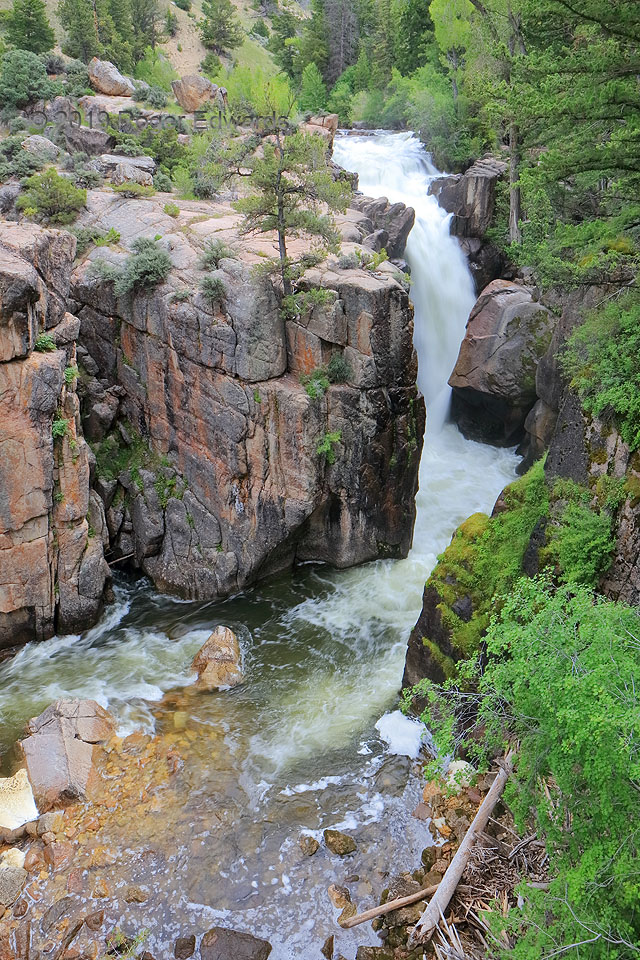
 Awakening fairly early on a moist Ranchester morning with supercell potential on the nearby High Plains, as well as being close to parts of the Bighorn Mountains I hadn’t seen before, I had choices. I could sit around some cafe, library, or my motel room, or hang out at a loud, busy truck stop for a few hours, killing time surfing the web, arguing about politics, and waiting for signs of initiation. Or I could make a quick morning forecast to revisit back there in a few hours, toss my fishing and camera gear into the car, and head into the mountains for scenes never seen before, photography thereof, and a little wettin’ of the line. Easy choice! The first stop was the farthest: Shell Falls, on the western slope of the range. This snowmelt-laden cascade drops Shell Creek 120 feet over Precambrian granite along its loopy path to the Bighorn River, the Missouri River, and ultimately, the Gulf of Mexico, source of the much of the humidity in the air. Between this and the fishing, the choice was validated, and a supercell ultimately did form and posed for the same lens used here. This was a good day.
9 ENE Shell WY (8 Jul 19) Looking E
44.5865, -107.6144
Awakening fairly early on a moist Ranchester morning with supercell potential on the nearby High Plains, as well as being close to parts of the Bighorn Mountains I hadn’t seen before, I had choices. I could sit around some cafe, library, or my motel room, or hang out at a loud, busy truck stop for a few hours, killing time surfing the web, arguing about politics, and waiting for signs of initiation. Or I could make a quick morning forecast to revisit back there in a few hours, toss my fishing and camera gear into the car, and head into the mountains for scenes never seen before, photography thereof, and a little wettin’ of the line. Easy choice! The first stop was the farthest: Shell Falls, on the western slope of the range. This snowmelt-laden cascade drops Shell Creek 120 feet over Precambrian granite along its loopy path to the Bighorn River, the Missouri River, and ultimately, the Gulf of Mexico, source of the much of the humidity in the air. Between this and the fishing, the choice was validated, and a supercell ultimately did form and posed for the same lens used here. This was a good day.
9 ENE Shell WY (8 Jul 19) Looking E
44.5865, -107.6144Shell Falls and Shell Creek
 Awakening fairly early on a moist Ranchester morning with supercell potential on the nearby High Plains, as well as being close to parts of the Bighorn Mountains I hadn’t seen before, I had choices. I could sit around some cafe, library, or my motel room, or hang out at a loud, busy truck stop for a few hours, killing time surfing the web, arguing about politics, and waiting for signs of initiation. Or I could make a quick morning forecast to revisit back there in a few hours, toss my fishing and camera gear into the car, and head into the mountains for scenes never seen before, photography thereof, and a little wettin’ of the line. Easy choice! The first stop was the farthest: Shell Falls, on the western slope of the range. This snowmelt-laden cascade drops Shell Creek 120 feet over Precambrian granite along its loopy path to the Bighorn River, the Missouri River, and ultimately, the Gulf of Mexico, source of the much of the humidity in the air. Between this and the fishing, the choice was validated, and a supercell ultimately did form and posed for the same lens used here. This was a good day.
9 ENE Shell WY (8 Jul 19) Looking E
44.5865, -107.6144