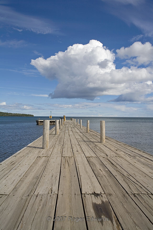
 This small, squatty cumulonimbus cloud, in a very picturesque setting, moved quickly toward the SE from the Minnesota Arrowhead over Lake Superior. It eventually developed a visible precipitation core well offshore. Several broader and slightly deeper thunderheads had developed earlier the same day inland, over stronger surface heating. The high bases came from a lack of richer low level moisture, which is common in post-frontal, northwest-flow environments; but there was enough moisture and unstable air aloft to support this formation. A capping inversion in middle–upper levels kept this convection from growing any deeper, so the top of the plume began glaciating with the early stage of an anvil spreading off the rear left (ESE) side of the towers. The Cb traveled through clean, deeply blue skies, as seen looking down a pier at Grand Portage National Monument.
2 S Grand Portage MN (12 Jul 7) Looking SE
47.9617, -89.6847
This small, squatty cumulonimbus cloud, in a very picturesque setting, moved quickly toward the SE from the Minnesota Arrowhead over Lake Superior. It eventually developed a visible precipitation core well offshore. Several broader and slightly deeper thunderheads had developed earlier the same day inland, over stronger surface heating. The high bases came from a lack of richer low level moisture, which is common in post-frontal, northwest-flow environments; but there was enough moisture and unstable air aloft to support this formation. A capping inversion in middle–upper levels kept this convection from growing any deeper, so the top of the plume began glaciating with the early stage of an anvil spreading off the rear left (ESE) side of the towers. The Cb traveled through clean, deeply blue skies, as seen looking down a pier at Grand Portage National Monument.
2 S Grand Portage MN (12 Jul 7) Looking SE
47.9617, -89.6847Shallow Cumulonimbus
 This small, squatty cumulonimbus cloud, in a very picturesque setting, moved quickly toward the SE from the Minnesota Arrowhead over Lake Superior. It eventually developed a visible precipitation core well offshore. Several broader and slightly deeper thunderheads had developed earlier the same day inland, over stronger surface heating. The high bases came from a lack of richer low level moisture, which is common in post-frontal, northwest-flow environments; but there was enough moisture and unstable air aloft to support this formation. A capping inversion in middle–upper levels kept this convection from growing any deeper, so the top of the plume began glaciating with the early stage of an anvil spreading off the rear left (ESE) side of the towers. The Cb traveled through clean, deeply blue skies, as seen looking down a pier at Grand Portage National Monument.
2 S Grand Portage MN (12 Jul 7) Looking SE
47.9617, -89.6847