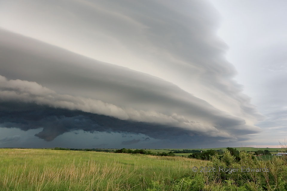
Sometimes, especially with heavy-precipitation and/or outflow-dominant storms, the most intricate and beautiful structures happen after the supercell stage. Such was true here, when a line-absorbed former supercell surged the entire complex forward, lifting layer upon layer over its cold pool in a deeply laminar, sometimes wavy pattern that still was convective down low. But for this storm’s frenetic forward speed, I could have stood here on the undulating green carpet of the northern Flint Hills and appreciated these cloud forms for hours. Instead, the timescale for moving on was less than a minute!
4 NW McFarland KS (13 Jun 26) Looking NE
39.1018, -96.2827