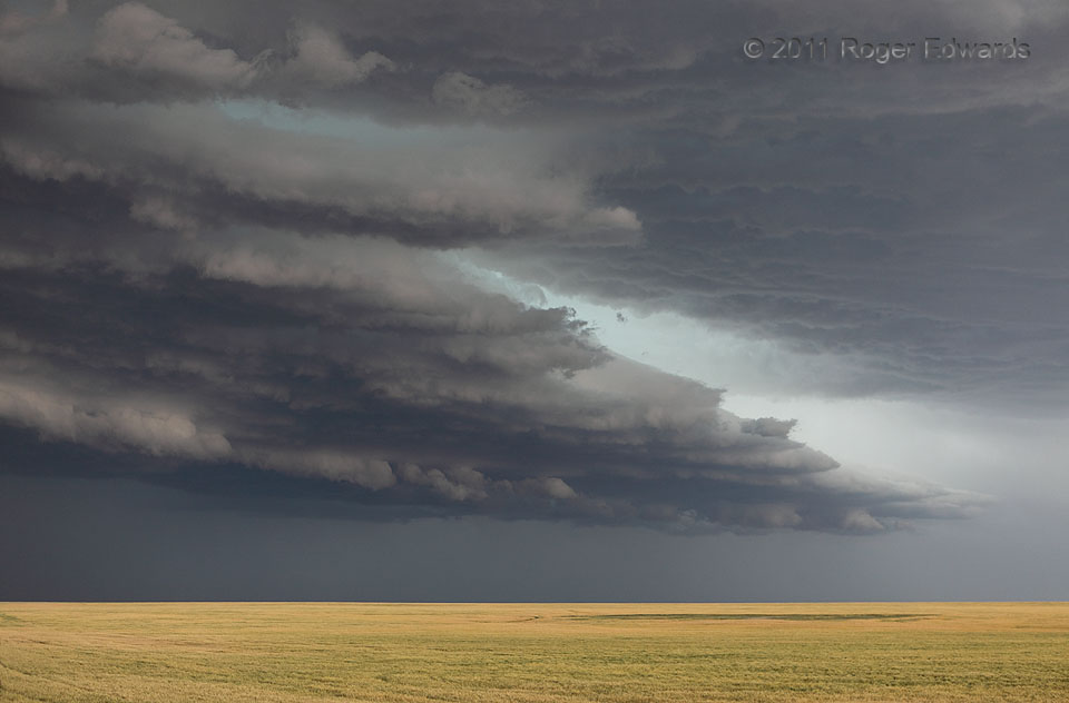
 [Part 2 of 4] A high-based, sharply defined, jagged-edged shelf cloud surges southeastward over the high plains of eastern Colorado, from a supercell evolving into an outflow-blasting multicell. In this region, a lack of richer subcloud humidity and haze usually helps to reduce the condensation down to a very sculpted form, representing only the strongest fingers and slabs of lift. It’s an exhibition of convective starkness, an efficiently constructed cloudscape that is free of the low-visibility grunge and scuddy material often accompanying outflow surges in moister areas. As a result, the complex cloud-base textures and subtle varieties of storm coloration can quilt together a sky that is amazing to behold. The outflow surge most certainly did not mean that the chase day was over; instead, it offered more amusement, amazement and wonder.
3 NNW Sheridan Lake CO (18 Jun 11) Looking NE
38.5139, -102.3083
[Part 2 of 4] A high-based, sharply defined, jagged-edged shelf cloud surges southeastward over the high plains of eastern Colorado, from a supercell evolving into an outflow-blasting multicell. In this region, a lack of richer subcloud humidity and haze usually helps to reduce the condensation down to a very sculpted form, representing only the strongest fingers and slabs of lift. It’s an exhibition of convective starkness, an efficiently constructed cloudscape that is free of the low-visibility grunge and scuddy material often accompanying outflow surges in moister areas. As a result, the complex cloud-base textures and subtle varieties of storm coloration can quilt together a sky that is amazing to behold. The outflow surge most certainly did not mean that the chase day was over; instead, it offered more amusement, amazement and wonder.
3 NNW Sheridan Lake CO (18 Jun 11) Looking NE
38.5139, -102.3083Serrated Arcus
 [Part 2 of 4] A high-based, sharply defined, jagged-edged shelf cloud surges southeastward over the high plains of eastern Colorado, from a supercell evolving into an outflow-blasting multicell. In this region, a lack of richer subcloud humidity and haze usually helps to reduce the condensation down to a very sculpted form, representing only the strongest fingers and slabs of lift. It’s an exhibition of convective starkness, an efficiently constructed cloudscape that is free of the low-visibility grunge and scuddy material often accompanying outflow surges in moister areas. As a result, the complex cloud-base textures and subtle varieties of storm coloration can quilt together a sky that is amazing to behold. The outflow surge most certainly did not mean that the chase day was over; instead, it offered more amusement, amazement and wonder.
3 NNW Sheridan Lake CO (18 Jun 11) Looking NE
38.5139, -102.3083