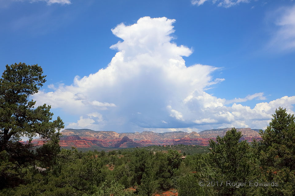
 The processes responsible for this seemingly innocuous little cumulonimbus, so young and frail in appearance, led indirectly to a photogenic downburst, a beautiful sunset and lightning over eight hours later and 150 miles to the west. What caused all those dominoes to fall? The answer is in our fascinating and active atmosphere. More such storms would form in the high country between Sedona and Flagstaff over the next hour, aggregating with this initial development under light easterly flow in midlevels to push outflow onto the high deserts just to the west. That, in turn, touched off more storms, which produced their westward-flowing outflow wall, which fired off still more convection…and so on, until this process of discrete forward propagation reached the Colorado River region that evening. Since one of the aims of my trip was storm photography in the sunset and evening hours, my mission was to keep up with the propagation process that long, wherever it led. Mission accomplished!
Sedona AZ (2 Aug 17) Looking N
34.8538, -111.8269
The processes responsible for this seemingly innocuous little cumulonimbus, so young and frail in appearance, led indirectly to a photogenic downburst, a beautiful sunset and lightning over eight hours later and 150 miles to the west. What caused all those dominoes to fall? The answer is in our fascinating and active atmosphere. More such storms would form in the high country between Sedona and Flagstaff over the next hour, aggregating with this initial development under light easterly flow in midlevels to push outflow onto the high deserts just to the west. That, in turn, touched off more storms, which produced their westward-flowing outflow wall, which fired off still more convection…and so on, until this process of discrete forward propagation reached the Colorado River region that evening. Since one of the aims of my trip was storm photography in the sunset and evening hours, my mission was to keep up with the propagation process that long, wherever it led. Mission accomplished!
Sedona AZ (2 Aug 17) Looking N
34.8538, -111.8269Newly Glaciated Cb, Sedona
 The processes responsible for this seemingly innocuous little cumulonimbus, so young and frail in appearance, led indirectly to a photogenic downburst, a beautiful sunset and lightning over eight hours later and 150 miles to the west. What caused all those dominoes to fall? The answer is in our fascinating and active atmosphere. More such storms would form in the high country between Sedona and Flagstaff over the next hour, aggregating with this initial development under light easterly flow in midlevels to push outflow onto the high deserts just to the west. That, in turn, touched off more storms, which produced their westward-flowing outflow wall, which fired off still more convection…and so on, until this process of discrete forward propagation reached the Colorado River region that evening. Since one of the aims of my trip was storm photography in the sunset and evening hours, my mission was to keep up with the propagation process that long, wherever it led. Mission accomplished!
Sedona AZ (2 Aug 17) Looking N
34.8538, -111.8269