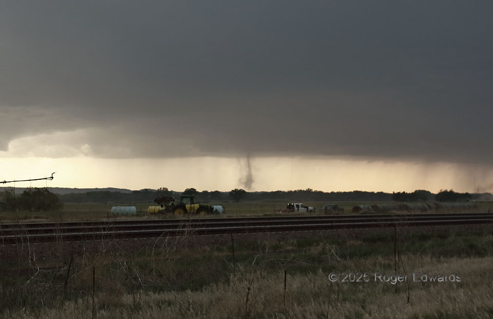
The second of a series of nonmesocyclonic “landspout” tornadoes, from a big-based multicell thunderstorm that later evolved into a supercell, appeared a couple minutes after the first one dissipated, and slightly farther northwest. This was a classic “spout” form, with a dust tube concentrated inside thinner dust centrifuged out of the vortex earlier. A very thin, diffuse tube to the right (N) of the very visible spout, and beyind the lit truck, may have been another, very short-lived vortex, or a narrow rain shaft; it was too distant to call for sure. Either way, it lasted less than a minute before a third more-certain spout appeared slightly farther rightward.
2 ESE Maxwell NE (14 May 25) Looking W
41.0673, -100.4893