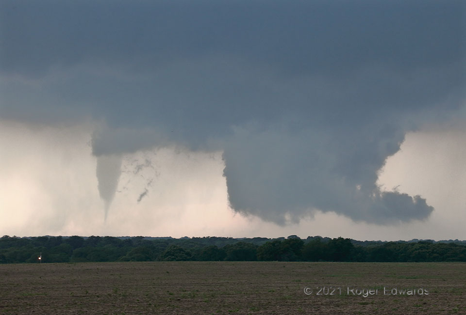
Late in a tornado’s life cycle, when accompanying a cyclic supercell, sometimes the vortex will separate from most of the updraft region and kick toward the rear of the storm, while a new mesocyclone (here represented by the wall cloud at right) organizes roughly downshear. Such a fate befell the “Blum tornado” in its last few minutes. [Another great example was the final stage of the 2010 Chugwater tornado.] Tornadoes don’t survive without a supportive deep convective updraft above. The new wall cloud rotated moderately at times, but never became tornadic, and the supercell woudl go on to cycle a couple more times without producing a tornado, before merging with other storms in deepening twilight darkness east of I-35.
1 NNW Osceola TX (3 May 21) Looking W
32.1509, -97.2412
