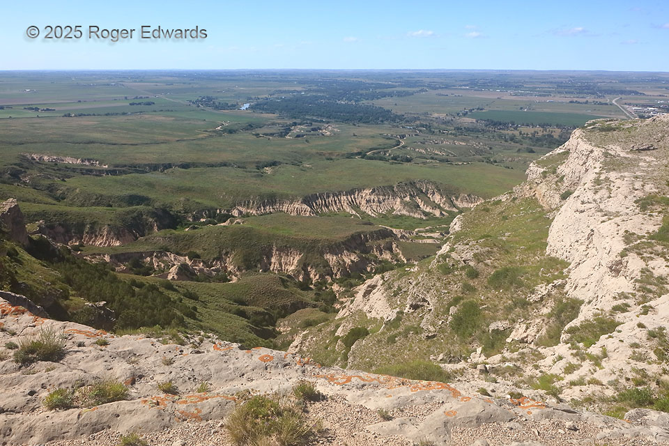
This time, we had to hike up Scotts Bluff because the road was closed for repairs. That’s OK, because it was an off day from chasing, so we (a tour group I was leading) had plenty of time in the area before spending the high in Alliance. Only a few of us made the steep trek, while others picnicked and/or relaxed at the bottom. This view was well worthwhile, as it is when driving and strolling the top of the bluff. So much for the Great Plains being “flat”! Smaller bluffs and gullies in ash beds that mark the drainages off the main northern “bluff” (actually a butte with a caliche caprock, as often found farther south under the High Plains), used as a navigational landmark for the Oregon and Mormon Trails that generally followed the North Platte River (seen at distant left center). With every heavy thunderstorms and flash flood, Scotts Bluff loses mass, the gullies deepen some, and the North Platte River deposits some more of this material at the bottom of Lake McConaughey. The orange patterns on the caprock are lichen colonies, symbiotic groupings of fungus and algae that produce the orange pigment as a sunscreen in exposed areas like this.
2 WNW Gering NE (30 Jun 25) Looking NW
41.8384, -103.6997