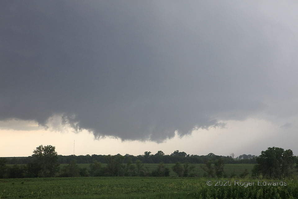
 This fast-approaching wall cloud came from a supercell that already had spun up a brief, small tornado just over the state line, in Kansas. Now in Nebraska, and even deeper into large hodographs within a warm-frontal zone, I was confident a tornado could form any time. This wall cloud rotated rather rapidly, with occasional, very short-lived chunks of scud shooting up from behind the trees. However, the scud elements were not themselves rotating, and therefore not tornadic. The visible motion between cloud and ground was upward, not around. The mesocyclone would occlude within a few minutes, before it got to me. I still had to execute my southeastward escape plan, however, because a new, messier, also ultimately nontornadic circulation soon formed a few miles to the left (southeast) of this one, and I wasn’t going to get caught on the wrong side, in heavy rain and perhaps large hail.
3 E Pawnee City NE (9 Jun 20) Looking SSW
40.1092, -96.0883
This fast-approaching wall cloud came from a supercell that already had spun up a brief, small tornado just over the state line, in Kansas. Now in Nebraska, and even deeper into large hodographs within a warm-frontal zone, I was confident a tornado could form any time. This wall cloud rotated rather rapidly, with occasional, very short-lived chunks of scud shooting up from behind the trees. However, the scud elements were not themselves rotating, and therefore not tornadic. The visible motion between cloud and ground was upward, not around. The mesocyclone would occlude within a few minutes, before it got to me. I still had to execute my southeastward escape plan, however, because a new, messier, also ultimately nontornadic circulation soon formed a few miles to the left (southeast) of this one, and I wasn’t going to get caught on the wrong side, in heavy rain and perhaps large hail.
3 E Pawnee City NE (9 Jun 20) Looking SSW
40.1092, -96.0883Rotation Incoming
 This fast-approaching wall cloud came from a supercell that already had spun up a brief, small tornado just over the state line, in Kansas. Now in Nebraska, and even deeper into large hodographs within a warm-frontal zone, I was confident a tornado could form any time. This wall cloud rotated rather rapidly, with occasional, very short-lived chunks of scud shooting up from behind the trees. However, the scud elements were not themselves rotating, and therefore not tornadic. The visible motion between cloud and ground was upward, not around. The mesocyclone would occlude within a few minutes, before it got to me. I still had to execute my southeastward escape plan, however, because a new, messier, also ultimately nontornadic circulation soon formed a few miles to the left (southeast) of this one, and I wasn’t going to get caught on the wrong side, in heavy rain and perhaps large hail.
3 E Pawnee City NE (9 Jun 20) Looking SSW
40.1092, -96.0883