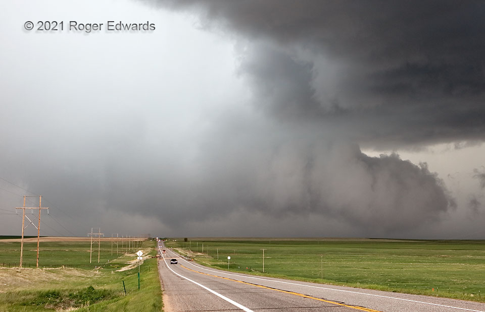
Even with decades of experience on hundreds of supercells, this was a challenging storm to spot well. After some messy mesocyclonic lowerings (but none I could say were tornadic with certainty) south-southwest of Last Chance, I had to zip up to the crossroads and head east, before the fast-moving mesocyclone and any potential cyclic successor(s) could cut off the turn option. Looking back in the rear-view mirror, I thought I saw condensation rising from the ground in the new primary mesocyclone, which was growing fast, but also was getting rain-wrapped. I pulled over as soon as safely possible and stuck my head and camera out for a view. This shot shows the remains of that lowering, just to the right of the highway and basically over the northern part of the mostly abandoned town of Last Chance. I couldn’t be certain enough to call it tornadic, however, especially given the low contrast, indirect initial look, and lack of apparent or later-reported damage. Wait—what’s that under the thick tail at right? Yes, a tornado can happen under the downshear tail of wall clouds, especially when they’re that convective in character with fast rising motion…and that was one! Only for about 20–30 seconds, obvious rotation appeared at cloud base and in the grounded condensation funnel, which I somehow caught at the right instant. I noticed it first in the camera LCD, then with eyeballs. The lesson: don’t get too fixated on one “textbook” area of a supercell and miss something important happening nearby. I had no cellular service here, and given all the chasers around, was hoping someone else who did would notice and report this brief spinup. It indeed soon appeared online from an NWS local storm report as a tornado “2 N Last Chance”. If the other circulation closer to US-36 was tornadic, it was too brief and weak to have meaningful effect.
5 E Last Chance CO (23 May 21) Looking WNW
39.7397, -103.5002