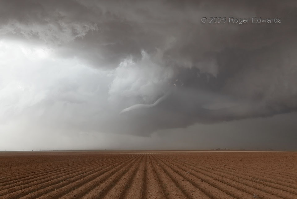
Even though this was somewhat closer to the town of Meadow, it wasn’t far SW of Ropesville either. I like the latter name better, as it describes what was happening. Still raising a thin swirl of dust (clearly not over a furrowed field as in the foreground!), this dying tornado had been deeply wrapped in rain for, “I don’t know how long.” As has been true many times before, including earlier the same year in the same region, I was highly confident a tornado was “in there” from its radar presentation, but couldn’t see it, at least until the bulk of the precip cage essentially fell out of the storm all at once. That left this deeply occluded, remnant wall cloud with classic RFD clear slot and shriveling tornado cyclone behind. A younger, more mature, but nontornadic mesocyclone lurked at rear, while a newer one formed offscreen to the right, connected by a tail cloud along a deformation zone. As previous mesocyclones with this storm had done before getting too wet, the new one soon would involve ridiculous amounts of inflow dust as well.
2 WSW Meadow TX (6 Jun 25) Looking N
33.3264, -102.2449