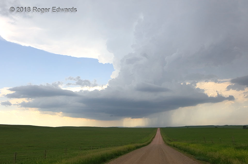
 As the “Black Hills supercell” peeled further southeastward away from its formative zone in the northern part of the now-distant hills, it got a little less organized, the cloud tails and overall base structure elongating along its own forward-flank outflow, while maintaining a remarkably erect updraft structure. Soon, additional updrafts would develop atop the eastward extension toward us, and the storm evolved into a messy, linear configuration. It was moving over Hermosa at the time, toward the small Lakota tribal community of Red Shirt, while offering this splendid view from the Pine Ridge Reservation. We couldn’t enjoy this view for long, since the dirt road went west toward the storm a bit before turning south, and rain and hail were falling not far to the right. This seldom-visited stretch of the High Plains, between the Black Hills, Badlands and Pine Ridge, offer few roads but some outstanding places to watch the stormy sky.
13 NNW Red Shirt SD (8 Jun 18) Looking W
43.8394, -102.983
As the “Black Hills supercell” peeled further southeastward away from its formative zone in the northern part of the now-distant hills, it got a little less organized, the cloud tails and overall base structure elongating along its own forward-flank outflow, while maintaining a remarkably erect updraft structure. Soon, additional updrafts would develop atop the eastward extension toward us, and the storm evolved into a messy, linear configuration. It was moving over Hermosa at the time, toward the small Lakota tribal community of Red Shirt, while offering this splendid view from the Pine Ridge Reservation. We couldn’t enjoy this view for long, since the dirt road went west toward the storm a bit before turning south, and rain and hail were falling not far to the right. This seldom-visited stretch of the High Plains, between the Black Hills, Badlands and Pine Ridge, offer few roads but some outstanding places to watch the stormy sky.
13 NNW Red Shirt SD (8 Jun 18) Looking W
43.8394, -102.983Rolling past Red Shirt
 As the “Black Hills supercell” peeled further southeastward away from its formative zone in the northern part of the now-distant hills, it got a little less organized, the cloud tails and overall base structure elongating along its own forward-flank outflow, while maintaining a remarkably erect updraft structure. Soon, additional updrafts would develop atop the eastward extension toward us, and the storm evolved into a messy, linear configuration. It was moving over Hermosa at the time, toward the small Lakota tribal community of Red Shirt, while offering this splendid view from the Pine Ridge Reservation. We couldn’t enjoy this view for long, since the dirt road went west toward the storm a bit before turning south, and rain and hail were falling not far to the right. This seldom-visited stretch of the High Plains, between the Black Hills, Badlands and Pine Ridge, offer few roads but some outstanding places to watch the stormy sky.
13 NNW Red Shirt SD (8 Jun 18) Looking W
43.8394, -102.983