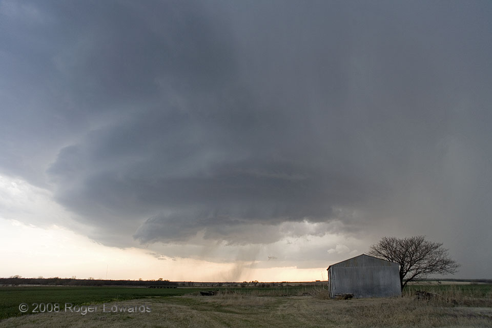
 Rounded, striated, tiered storm structures, often known as “stacks of plates”, are a common visual characteristic of dryline supercells like this, where low clouds or rain often don’t interfere with viewing from the inflow region. Notice the strong resemblance of the Rocky storm here to the “flipped” version of the Aroya anticyclonic supercell from several years before in Colorado. I surely did, in real time, and as a result, suspected strongly that the hail couldn’t be far off. Indeed, in this view, thin veils of precipitation above and beyond the barn and tree consisted largely of hail, as is common for precip cascading down through the “vault” region between the main updraft and downshear (forward-flank) areas. As we watched the supercell spin its way our way, some of the ice balls began to bounce around us, compelling our repositioning further southward and eastward for more photography of this strikingly structured storm. Right after we left, hailstones up to two inches in diameter fell very near this spot.
2 S Rocky OK (30 Mar 8) Looking W
35.1343, -99.061
Rounded, striated, tiered storm structures, often known as “stacks of plates”, are a common visual characteristic of dryline supercells like this, where low clouds or rain often don’t interfere with viewing from the inflow region. Notice the strong resemblance of the Rocky storm here to the “flipped” version of the Aroya anticyclonic supercell from several years before in Colorado. I surely did, in real time, and as a result, suspected strongly that the hail couldn’t be far off. Indeed, in this view, thin veils of precipitation above and beyond the barn and tree consisted largely of hail, as is common for precip cascading down through the “vault” region between the main updraft and downshear (forward-flank) areas. As we watched the supercell spin its way our way, some of the ice balls began to bounce around us, compelling our repositioning further southward and eastward for more photography of this strikingly structured storm. Right after we left, hailstones up to two inches in diameter fell very near this spot.
2 S Rocky OK (30 Mar 8) Looking W
35.1343, -99.061Rocky Hailer
 Rounded, striated, tiered storm structures, often known as “stacks of plates”, are a common visual characteristic of dryline supercells like this, where low clouds or rain often don’t interfere with viewing from the inflow region. Notice the strong resemblance of the Rocky storm here to the “flipped” version of the Aroya anticyclonic supercell from several years before in Colorado. I surely did, in real time, and as a result, suspected strongly that the hail couldn’t be far off. Indeed, in this view, thin veils of precipitation above and beyond the barn and tree consisted largely of hail, as is common for precip cascading down through the “vault” region between the main updraft and downshear (forward-flank) areas. As we watched the supercell spin its way our way, some of the ice balls began to bounce around us, compelling our repositioning further southward and eastward for more photography of this strikingly structured storm. Right after we left, hailstones up to two inches in diameter fell very near this spot.
2 S Rocky OK (30 Mar 8) Looking W
35.1343, -99.061